Karakoy history is closely tied to Galata, the historic settlement on the north side of Istanbul’s Golden Horn. For centuries, this waterfront area linked Constantinople and later Ottoman Istanbul with Mediterranean and Black Sea trade networks. Its surviving towers, churches, banks, streets, transport links, and port buildings still show how the district changed from a medieval trading colony into a modern urban neighborhood.
Quick Answer
Karakoy developed from historic Galata, a Byzantine settlement that became a Genoese commercial colony in 1267. After the Ottoman conquest of 1453, it remained an important port and trading district. During the 19th century, banking, modern transport, and new waterfront infrastructure turned Karakoy into one of Istanbul’s major commercial centers.
Key Takeaways
- Galata was already part of Constantinople in the Byzantine period before a Genoese commercial colony was established there in 1267.
- The Genoese built the core of today’s Galata Tower in 1348 as part of their fortified settlement.
- Under Ottoman rule, the waterfront remained commercially important and became increasingly cosmopolitan.
- The 19th century brought the Galata Bridge, Tünel railway, banks, insurance companies, and major new commercial buildings.
- Karakoy’s modern identity still reflects its older roles as a port, transport junction, financial district, and meeting point between communities.
How Did Karakoy Begin?
The earliest layers of Karakoy history belong to Galata, the settlement facing historic Constantinople across the Golden Horn. Research on Galata’s urban development identifies it as the 13th region of Constantinople during the Byzantine period, long before the district became associated with Genoese merchants.
The decisive medieval change came in 1267, when the Genoese established their commercial colony of Pera in Galata. Academic research from Istanbul Technical University describes the Genoese period as lasting from 1267 until the Ottoman conquest in 1453 and as a major phase in the area’s urban and architectural development. You can read the ITU study of Galata’s urban history for the archaeological and historical context.
The colony grew into a fortified commercial settlement beside the Golden Horn. Warehouses, houses, churches, streets, defenses, and trading facilities served merchants working between Constantinople, the Mediterranean, and ports around the Black Sea.
Its best-known surviving monument is Galata Tower. According to the Turkish Ministry of Culture and Tourism, the Genoese settlement expanded uphill and developed fortifications between 1335 and 1349. The tower in its present historical form dates to 1348.
The same official Galata Tower Museum guide gives the tower’s height to the roof tip as 62.59 meters. It also records later earthquake, fire, restoration, and functional changes that explain why today’s tower contains elements from several periods rather than representing one untouched medieval structure.
The origin of the modern name Karakoy is less certain than the earlier version of this article suggested. Galata remained the established historical name for the wider area for centuries, while Karakoy became the name associated with the waterfront quarter. Because competing explanations exist for the name’s origin, it is safer not to treat a single etymology as proven.
Karakoy in the Ottoman Empire
After the Ottoman conquest of Constantinople in 1453, Galata did not stop functioning as a commercial district. The Genoese colony passed under Ottoman authority, while the area’s port, workshops, markets, religious institutions, and merchant communities continued to shape life on the north side of the Golden Horn.
Over time, Ottoman institutions were added to the inherited urban fabric. Muslim, Christian, and Jewish communities all left architectural and commercial traces in Galata and Karakoy. This diversity is still visible in the area’s mosques, churches, synagogues, hans, warehouses, and commercial buildings.
The 19th century was especially important. Trade expanded, European commercial connections deepened, and Karakoy became a center for banking and insurance. Voyvoda Caddesi, now better known as Bankalar Caddesi or Banks Street, developed into one of the Ottoman capital’s most important financial streets.
The Ottoman Bank began operations in Istanbul in 1856 and became the Imperial Ottoman Bank in 1863. Its later headquarters on Bankalar Caddesi served the bank from 1892 to 1999. The building now houses SALT Galata and the Ottoman Bank Museum, whose archives and displays document the financial and social history of the late Ottoman and early Republican periods. The Ottoman Bank Museum history provides the institution’s chronology.
The Galata Bridge Changed Movement Through the City
The first permanent Galata Bridge of the modern era opened in 1845, linking the Karakoy-Galata side of the Golden Horn more directly with the historic peninsula. Istanbul Metropolitan Municipality records that the wooden bridge was commissioned during Sultan Abdülmecid’s reign by his mother, Bezmialem Valide Sultan.
Later bridges replaced that structure as traffic increased. The municipal history of the Galata Bridge records major replacements in 1863 and 1912, the arrival of electric trams across the bridge in 1914, and construction of the present bridge after the old structure was badly damaged by fire in 1992.
Tünel Linked Galata With Pera
Another major transport change came with Tünel, the underground funicular connecting the lower Galata-Karakoy area with Beyoglu. The line reduced the difficult climb between the commercial waterfront and the growing districts above it.
According to IETT’s official Tünel history, construction began in 1871, was completed in December 1874, and passenger service started on January 17, 1875. IETT describes it as the world’s second-oldest underground railway after London’s.
Karakoy in the 20th Century
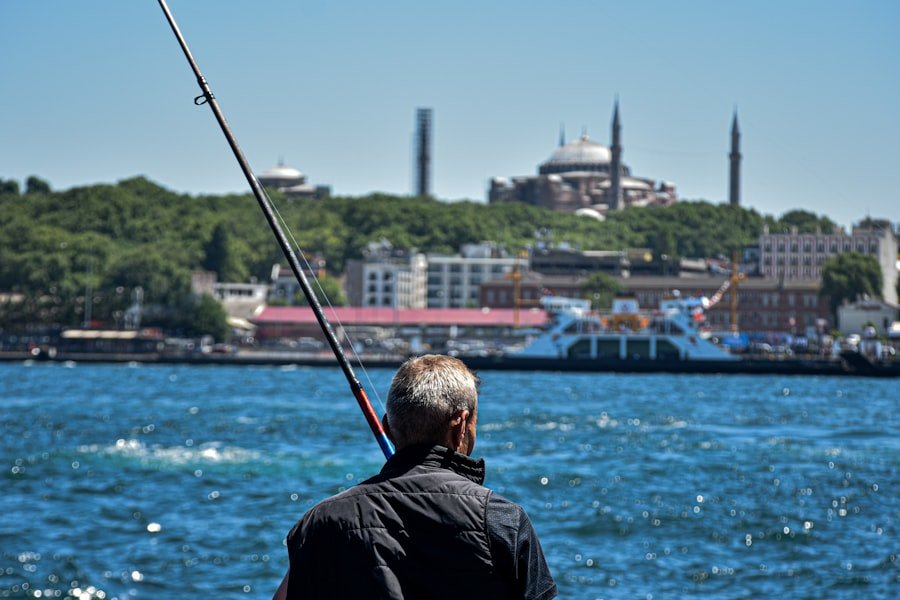
The 20th century changed Karakoy’s political setting, port infrastructure, and economy. The Ottoman Empire ended, the Republic of Turkey was established in 1923, and Istanbul’s older commercial districts had to adapt to new transport systems, industries, business centers, and patterns of migration.
The waterfront remained central to that story. Karakoy and the adjoining Salipazari port area accumulated passenger facilities, customs functions, warehouses, and other maritime infrastructure during the late Ottoman and Republican periods.
According to the documented history of the Karakoy-Salipazari waterfront, a pier was constructed in 1892. Major port buildings followed in the early 20th century, including structures built between 1907 and 1914. A new Karakoy passenger terminal was completed in 1940, while additional Salipazari warehouses were built in the 1950s.
The port was used heavily for freight before cruise traffic became more important in the later 20th century. Meanwhile, Karakoy remained a working commercial district filled with wholesalers, workshops, shipping-related businesses, hardware sellers, offices, banks, and transport connections.
Its role was therefore broader than tourism. For much of the century, Karakoy was a place where people arrived, transferred between transport systems, bought industrial and commercial goods, worked in offices, and moved between the waterfront and Beyoglu.
The Transformation of Karakoy
Karakoy’s more recent transformation did not erase its commercial past; it reused much of the urban fabric created by it. Former banks, warehouses, workshops, port buildings, and historic commercial streets increasingly gained cultural, hospitality, dining, retail, and creative uses.
Bankalar Caddesi offers one of the clearest examples. The former Imperial Ottoman Bank headquarters became SALT Galata in 2011. Instead of losing the building’s connection with financial history, the new cultural use incorporates the Ottoman Bank Museum and research collections.
The waterfront experienced a larger physical change. Redevelopment of the Karakoy-Salipazari port zone followed decades of proposals and a major port tender in 2013. Historic port buildings were incorporated into a new waterfront complex alongside cruise facilities, public spaces, shops, restaurants, offices, hotels, and cultural venues.
This shift changed the balance of activity in the district. Karakoy still works as a transport and commercial junction, but visitors now encounter its industrial and financial heritage alongside museums, galleries, restaurants, cafes, design businesses, and restored historic structures.
Karakoy Today
Today’s Karakoy combines several identities within a compact area. It is a waterfront transport point, an extension of historic Galata, a former financial district, a commercial neighborhood, and a major visitor destination.
The streets closest to the Golden Horn retain the dense pattern created by centuries of trade. Moving uphill toward Galata Tower reveals another layer: steep streets, passages, religious buildings, surviving fragments of old fortifications, and the monumental banking architecture around Bankalar Caddesi.
That mixture explains why Karakoy can feel different from a purpose-built tourism district. A visitor can move within a short walk from ferry activity and older trade streets to 19th-century banks, medieval remains, contemporary cultural spaces, restaurants, and the streets climbing toward Galata Tower.
The area’s food and cafe scene is now highly visible, but it is only the newest layer of a much longer commercial story. Taverns, coffeehouses, markets, restaurants, merchants, shipping businesses, and financial institutions have all occupied parts of this waterfront district at different points in its history.
Historical Landmarks in Karakoy
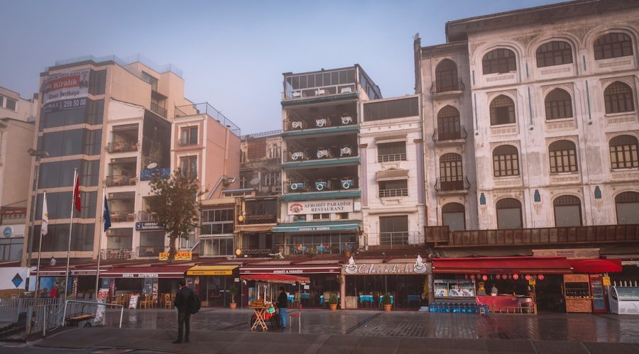
Karakoy’s most useful landmarks are not simply isolated monuments. Together, they explain the district’s transition from Genoese Galata through Ottoman commercial expansion to the modern city.
Galata Tower
Galata Tower is the most recognizable surviving monument associated with Genoese Galata. The existing tower dates to 1348 and formed part of the settlement’s defensive system. After 1453, its functions changed several times under Ottoman rule, including periods of use connected with surveillance and fire observation.
The tower suffered damage from earthquakes, fires, and storms and was repeatedly repaired. Those changes make it a physical record of the many periods through which Galata passed rather than a structure frozen in its 14th-century form.
Bankalar Caddesi and SALT Galata
Bankalar Caddesi preserves the architecture of Karakoy’s financial age. Its substantial commercial buildings reflect the importance of banking, insurance, international trade, and finance in late Ottoman Istanbul.
The former Imperial Ottoman Bank headquarters is especially significant because its function is well documented and much of its institutional history remains accessible through the Ottoman Bank Museum. It connects the street’s architecture directly with the economic history that shaped Karakoy.
Kamondo Stairs
The Kamondo Stairs connect levels of the steep Galata streets near Bankalar Caddesi. They were commissioned by the prominent Kamondo banking family and are one of the district’s most distinctive 19th-century urban features.
Istanbul’s official tourism portal describes the stairs as a product of the Ottoman Jewish Kamondo family’s presence in the commercial district. The Istanbul tourism history of the Kamondo Stairs dates them to the 19th century and explains their role as a practical connection through Galata’s steep terrain.
Church of Saints Peter and Paul
The Church of Saints Peter and Paul reflects Galata’s long Latin Catholic presence. Dominican friars had been active in the area for centuries, although their churches were repeatedly altered, destroyed, rebuilt, or reassigned as the city changed.
The church’s own historical record states that the Dominicans commissioned architect Gaspare Fossati to design the present building after demolishing its predecessor in 1841. The new Church of Saints Peter and Paul was consecrated in 1843 and was designed in a neoclassical style. Its rear wall incorporates remains of the Genoese walls of Galata.
Galata Bridge
Galata Bridge is important to Karakoy because it physically tied the district more closely to Eminonu and the historic peninsula. Successive bridges changed pedestrian, commercial, tram, and road movement across the Golden Horn.
For visitors studying Karakoy history, the bridge also helps explain why the waterfront became such a powerful transport junction. Sea routes, bridge traffic, Tünel, and later tram connections converged within the same relatively small area.
Karakoy’s Cultural and Artistic Heritage
Karakoy’s cultural character comes from layers of communities and occupations rather than from one period alone. Genoese, Greek, Armenian, Jewish, Latin Catholic, Muslim Ottoman, European, and Republican-era institutions all contributed to the district’s built environment.
Religious buildings are one visible part of that history. Churches, synagogues, and mosques survived alongside commercial buildings because Galata and Karakoy served diverse communities involved in trade, diplomacy, finance, crafts, shipping, and urban services.
Architecture provides another layer. Medieval defensive remains sit near Ottoman religious buildings, 19th-century banks, commercial hans, early 20th-century port structures, and later adaptations. This makes walking through Karakoy useful for understanding how Istanbul repeatedly reused the same urban space rather than replacing every earlier period.
The district’s modern art and cultural venues continue that pattern of reuse. Former commercial and financial buildings now accommodate exhibitions, archives, museums, libraries, restaurants, and other public uses. In this sense, Karakoy’s cultural revival is closely connected to its older economic architecture.
Karakoy’s Economic and Commercial Significance
Trade is the strongest thread connecting the different periods of Karakoy history. The types of business changed, but the district’s waterfront location repeatedly made it useful for moving people, goods, money, and information.
In the Genoese period, the port connected a merchant colony with wider Mediterranean and Black Sea networks. Under the Ottomans, commerce continued while new institutions and communities reshaped the district. By the 19th century, finance joined maritime trade as one of Galata-Karakoy’s defining activities.
The development of Bankalar Caddesi concentrated banks and related businesses close to the port. The Galata Bridge increased movement across the Golden Horn, while Tünel connected the waterfront with Pera and Beyoglu. These systems reinforced one another: ships brought people and goods to the shore, while bridges, streets, and rail links moved them through the city.
During the 20th century, port terminals, warehouses, wholesalers, workshops, and transportation remained important even as Istanbul’s main financial institutions gradually shifted elsewhere. In the 21st century, passenger shipping, tourism, culture, hospitality, retail, and dining have become more visible parts of the local economy.
Karakoy therefore illustrates a broader pattern in Istanbul’s development. Its importance did not depend on one industry. The district repeatedly adapted its strategic waterfront position to new forms of trade, finance, transport, culture, and urban life.
If you’re interested in exploring more about the history of different regions, you may enjoy reading about the delightful world of Asian melon. This article covers the origins, varieties, cultural significance, and culinary uses of the fruit. Check it out here.
Frequently Asked Questions
What is the history of Karakoy?
Karakoy developed from the historic Galata waterfront on the north side of Istanbul’s Golden Horn. Galata became a Genoese commercial colony in 1267, passed under Ottoman rule in 1453, expanded as a port and financial district, and later evolved into the transport, cultural, commercial, and visitor district seen today.
Are Karakoy and Galata the same place?
Karakoy and Galata overlap historically, but the names are not always used in exactly the same way. Galata is the older name for the wider historic settlement north of the Golden Horn, while Karakoy commonly refers to the lower waterfront area around the bridge, port, ferry connections, and streets below Galata Tower.
What are the main historical landmarks in Karakoy?
Important landmarks include Galata Tower, Bankalar Caddesi, the former Imperial Ottoman Bank building at SALT Galata, the Kamondo Stairs, the Church of Saints Peter and Paul, and Galata Bridge. Together, they represent Karakoy’s Genoese, Ottoman, financial, religious, commercial, and transport history.
Why was Karakoy important to Ottoman Istanbul?
Karakoy was important because its port connected Ottoman Istanbul with international trade while its streets supported merchants, shipping businesses, banks, insurers, and other commercial institutions. In the 19th century, Bankalar Caddesi became a major financial center, and new transport links strengthened Karakoy’s connection with the rest of the city.
How has Karakoy changed over time?
Karakoy changed from a medieval port district into an Ottoman commercial and financial center, then into a major Republican-era transport and working port zone. More recently, historic banks, warehouses, and commercial buildings have gained cultural, hospitality, dining, retail, and visitor uses while the district remains an important transport and business area.
Sources
- Istanbul Technical University, A|Z Journal: Galata’s Byzantine urban history and Genoese period from 1267 to 1453.
- Türkiye Ministry of Culture and Tourism, Galata Tower Museum: Genoese colony chronology, 1348 tower date, later alterations, and official tower measurements.
- Istanbul Metropolitan Municipality: History of the Galata Bridge and its successive replacements.
- IETT: Construction and opening history of the Karakoy-Beyoglu Tünel railway.
- SALT Ottoman Bank Museum: Ottoman Bank chronology and its role in the late Ottoman financial system.
- Visit Istanbul: History and setting of the Kamondo Stairs.
- Church of Saints Peter and Paul in Galata: Dominican history, Gaspare Fossati’s church, and the 1843 consecration.
- Galataport Istanbul: Historical development of the Karakoy-Salipazari port and its waterfront buildings.