When I think of Switzerland, the Matterhorn is still the image that comes to mind first. Rising to 4,478 metres above Zermatt, its sharp pyramid profile dominates many of the best photography locations in the region. What makes Zermatt especially rewarding for photographers is the variety: you can frame the mountain from village streets, mirror it in alpine lakes, or photograph it from viewpoints more than 3,000 metres above sea level.
Quick Answer
The best photo spots in Zermatt include Kirchbrücke and the old village for easy Matterhorn views, Gornergrat and Riffelsee for high-alpine panoramas, Sunnegga and Stellisee for lake reflections, Schwarzsee for a close mountain perspective, and Matterhorn Glacier Paradise or Rothorn for sweeping views. Check weather and lift status before heading up.
Key Takeaways
- Gornergrat and nearby Riffelsee combine easy mountain-railway access with some of the classic Matterhorn views.
- Stellisee is one of Zermatt’s best-known locations for photographing the Matterhorn reflected in calm water.
- Kirchbrücke gives you a strong Matterhorn composition without requiring a mountain railway or long hike.
- Schwarzsee, Rothorn and Matterhorn Glacier Paradise provide very different high-alpine perspectives.
- Weather, clouds, wind and lift operations matter as much as the time of day, so check live conditions before travelling to a high viewpoint.
The light can change these scenes completely. Sunrise may put warm light on the Matterhorn while the village is still quiet, and late-day light can create strong contrast across the mountain’s ridges. I also learned that a famous viewpoint does not guarantee a photograph: cloud, wind and changing mountain weather can transform the scene within minutes.
Pro Tip: Before leaving Zermatt for a mountain viewpoint, check the official Zermatt webcams, weather forecast and current lift status. A clear village sky does not always mean the Matterhorn or higher stations will be cloud-free.
Gornergrat Railway: One of the Classic Matterhorn Viewpoints
Riding the Gornergrat Railway was one of the highlights of my time in Zermatt. The cogwheel railway climbs from the village to Gornergrat station at 3,089 metres, giving increasingly open views of the surrounding high mountains as it gains elevation. According to the official Gornergrat Bahn, the area looks across the Matterhorn, the Gorner Glacier and numerous 4,000-metre peaks.
The railway journey takes roughly 33 minutes from Zermatt to Gornergrat, so this is one of the easiest ways to reach a genuinely high-alpine photography location without completing a demanding climb. Once at the top, I like the combination of broad landscape compositions and tighter shots that isolate the Matterhorn against the surrounding ridges.
The observation area above the station is useful for wide panoramas. Instead of immediately shooting from the first place I reach, I prefer to walk around and look for foreground elements such as snow, rock or alpine vegetation. They give the frame more depth than a distant mountain alone.
Gornergrat station sits at 3,089 metres, putting photographers high above Zermatt with direct views into one of the most dramatic mountain landscapes in the region.
Riffelsee: The Matterhorn Reflection Near Gornergrat
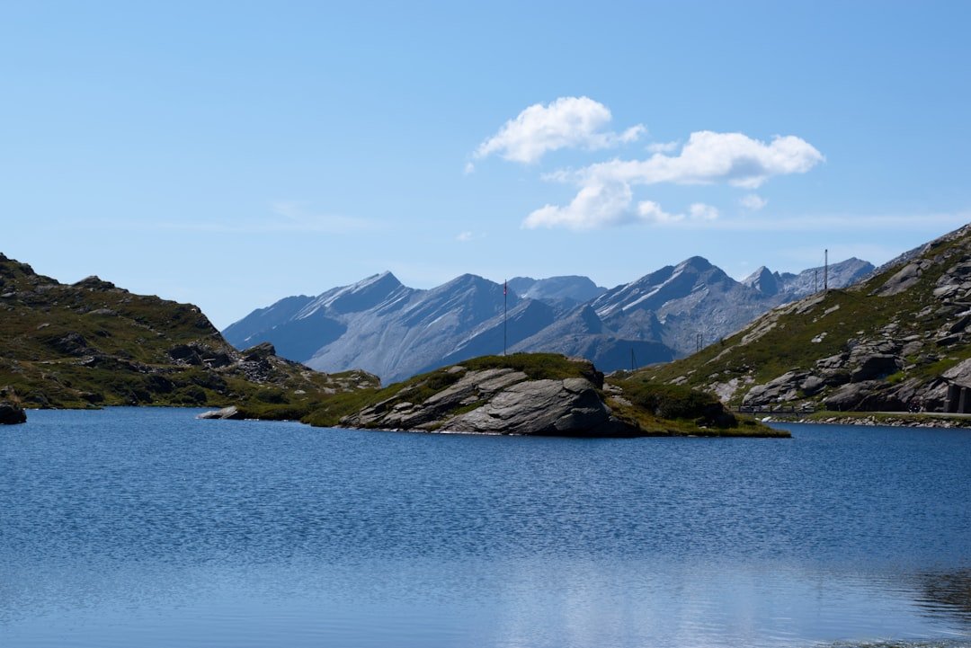
Riffelsee deserves its own place on a Zermatt photography list. Zermatt Tourism identifies the lake, at about 2,757 metres, as one of the region’s famous Matterhorn-reflection locations. It is reached from the Gornergrat railway route, with Rotenboden providing convenient access to the surrounding trails.
The photograph many people want here is the Matterhorn reflected on the lake surface. The most important factor is not simply sunrise or sunset, but calm water. Even modest wind can break the reflection into ripples. When the water is still, I look for a low shooting position that includes enough of the shoreline to anchor the composition without cutting into the reflection.
Cloud can also help rather than hurt. A completely empty blue sky can look flat, while broken clouds may add texture as long as they do not hide the Matterhorn itself.
Sunnegga: Easy Access to Matterhorn Views
Sunnegga is one of the easiest elevated viewpoints to reach from Zermatt. The underground funicular climbs to the 2,288-metre mountain station in about 4.5 minutes, according to Zermatt Tourism.
When I stepped out at Sunnegga, the Matterhorn immediately became the dominant feature of the landscape. The area works well when I want a mountain view without committing to a long hike, but it is also a starting point for trails leading toward several lakes and additional viewpoints.
Leisee lies below Sunnegga and can provide another foreground for the Matterhorn. Reflections depend on light, wind and water conditions, so I do not treat them as guaranteed. If the surface is moving, I switch from chasing a perfect reflection to using the lake, shoreline, flowers or hikers as foreground elements.
Stellisee: One of Zermatt’s Signature Reflection Photos
For a more recognizable Matterhorn-reflection composition, Stellisee is one of the strongest choices. Zermatt Tourism lists Stellisee at 2,537 metres and specifically highlights the reflection of the Matterhorn on its surface.
The lake can be approached from the Blauherd side of the Sunnegga-Rothorn area. This makes it a natural addition if I am already spending part of the day around Sunnegga or Rothorn rather than travelling to a completely separate mountain zone.
At Stellisee, I pay particular attention to three things: wind, clouds and foreground placement. Calm water helps create the classic mirror effect. A low viewpoint can make the reflected mountain more prominent, while moving a few metres along the shore can dramatically change the relationship between rocks, water and the Matterhorn.
Note: A reflection photograph depends on conditions. If wind removes the mirror effect, use the lake as foreground rather than waiting indefinitely for perfectly still water.
Schwarzsee: A Close View Beneath the Matterhorn
| Location | Above Zermatt, Valais, Switzerland |
| Mountain Station | 2,583 metres above sea level |
| Best Subject | Matterhorn north face, alpine lake and surrounding high-mountain terrain |
| Access | Mountain railway system from Zermatt, followed by local walking depending on the exact viewpoint |
| Photography Style | Close mountain compositions, lake foregrounds, hiking landscapes and dramatic weather |
Schwarzsee feels very different from the broad Gornergrat panorama. At 2,583 metres, the area sits much closer to the Matterhorn and gives a more imposing perspective of the mountain. The official Schwarzsee station information specifically highlights views toward the Matterhorn’s north face and the Hörnlihütte.
As I walked around the area, I found myself concentrating less on huge panoramas and more on the relationship between the mountain, lake and rough alpine terrain. The darker water and rocky foreground can create a stronger, more dramatic mood than the greener landscapes around Sunnegga.
This is also an area where changing weather can become part of the photograph. Low cloud around the upper Matterhorn may not give the classic postcard image, but it can create a powerful sense of scale if parts of the mountain remain visible.
Matterhorn Glacier Paradise: High-Alpine Panoramas at 3,883 Metres
Matterhorn Glacier Paradise is the highest viewpoint in this article. The lift system reaches 3,883 metres on the Klein Matterhorn, where the operator describes the station as the highest mountain station in Europe. The viewing platform opens onto a panorama containing high peaks and glaciers across Switzerland, Italy and France.
The environment here is visually different from Zermatt’s lower viewpoints. Snow, glacier ice and distant mountain layers dominate the scene. A wide-angle lens can emphasize the scale of the panorama, while a telephoto lens lets me isolate individual peaks and compress several mountain ridges into one frame.
The official Matterhorn Glacier Paradise experience also includes the Glacier Palace, where ice formations and sculptures offer a completely different type of photography from the outdoor landscape.
Warning: Matterhorn Glacier Paradise reaches 3,883 metres and Gornergrat is above 3,000 metres. Move at a comfortable pace and pay attention to symptoms such as headache, unusual fatigue, nausea or dizziness. Do not continue ascending when you feel unwell, and descend if symptoms worsen. People with medical concerns about high altitude should seek individual medical advice before travelling.
Gorner Gorge: Rock, Water and a Different Kind of Zermatt Photo
The Gorner Gorge gives photographers a useful break from repeated Matterhorn compositions. Instead of distant peaks, the subject becomes water, carved rock, texture and the narrow shape of the gorge itself.
Zermatt Tourism describes wooden walkways running between the cliffs, giving visitors close views of the rock formations and rushing water. The darker environment makes exposure more challenging than an open mountain viewpoint, but it also creates opportunities for more intimate compositions.
I look for curves in the rock and water that lead the eye through the frame. In shaded areas, a stable shooting position is useful because shutter speeds can become slower. Opening status and hours can change, so I check the official Gorner Gorge listing before planning a visit around it.
The Village of Zermatt: Kirchbrücke, Old Chalets and Street Scenes
Zermatt itself should not be treated as merely the place you sleep between mountain excursions. Some of the easiest and most characteristic photographs can be made without leaving the village.
Kirchbrücke is one of my favorite simple viewpoints because it gives a clear line toward the Matterhorn without requiring a train, cable car or hiking trail. Zermatt Tourism specifically identifies the bridge as a Matterhorn photo point and notes that photographers gather there around dawn in summer to catch the first sunlight on the summit.
The old village, or Hinterdorf, offers a completely different composition. Traditional wooden barns, stores and houses provide foreground interest and a stronger sense of local history. Zermatt Tourism says more than 30 buildings in this part of the village preserve the traditional Upper Valais style.
Zermatt is described as car-free because private vehicles are not permitted into the resort. Travellers arriving by car leave their vehicle in Täsch and continue by train, taxi or authorized service. That gives central Zermatt a very different atmosphere from a typical road-based resort, although you should still remain aware of local transport while photographing in streets.
I enjoy photographing the village early, before the busiest part of the day. Narrow streets, chalet details, church architecture and the Matterhorn can all work together in one frame. A moderate wide-angle lens is often more useful here than the very wide lens I might choose for a mountain panorama.
Rothorn: A Wide View of the Matterhorn and Surrounding Peaks
Rothorn provides another high-altitude perspective, but its view feels different from Gornergrat. The summit area reaches 3,103 metres, and Zermatt Tourism describes it as a vantage point for the freestanding Matterhorn and the surrounding 4,000-metre peaks.
I reach the Rothorn area by continuing upward through the Sunnegga-Blauherd mountain-transport network. Once at the top, the open terrain gives plenty of room to experiment with foreground placement rather than shooting from only one fixed platform.
The trails around Rothorn also make it possible to combine several photographic subjects in one outing. Depending on the route and operating conditions, photographers can connect the Rothorn area with the Stellisee side of the mountain rather than treating each place as an isolated excursion.
Of all the Zermatt viewpoints, Rothorn is one of the places where I most appreciate carrying both a wide-angle lens and a telephoto lens. The wide lens captures the scale of the landscape, while the longer focal length helps separate the Matterhorn from distant ridges and removes distracting foreground.
How to Plan a Photography Day in Zermatt
The biggest mistake I can make in Zermatt is planning entirely around a fixed clock time. Sunrise and sunset matter, but mountains create their own weather. A viewpoint that looks perfect on a forecast may disappear behind cloud, while another area may stay completely clear.
I start by checking webcams and the current weather. Then I look at live lift information before choosing a high mountain destination. This is especially important outside peak seasons, when maintenance periods or weather can affect access.
If lake reflections are my priority, I favor calmer conditions. If clouds are moving quickly, I may instead choose Gornergrat, Rothorn or a village viewpoint where changing light across the mountain can become part of the scene.
I also avoid trying to cover every location in one day. Gornergrat and Riffelsee pair naturally. Sunnegga, Stellisee and Rothorn belong to another useful group. Schwarzsee and Matterhorn Glacier Paradise can also be combined depending on current lift operations. Kirchbrücke and the old village fit easily around almost any day because they are in Zermatt itself.
Camera Gear That Works Well in Zermatt
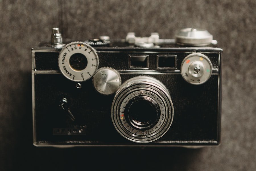
You do not need an enormous camera bag to photograph Zermatt well. I would prioritize a camera or phone I am comfortable using, spare power, weather protection and footwear suitable for the location.
- Wide-angle lens: useful for lakes, mountain panoramas, village architecture and close foregrounds.
- Standard zoom: the most flexible choice if I want to travel light.
- Telephoto lens: useful for isolating the Matterhorn, distant climbers, ridges and compressed mountain layers.
- Tripod: helpful for low-light village photography and careful reflection compositions where permitted and practical.
- Polarizing filter: can reduce glare and deepen some landscape colors, although I use it cautiously on very wide lenses because the sky can become uneven.
- Spare batteries: cold conditions can shorten battery performance.
- Rain and cold protection: mountain conditions can change quickly even when Zermatt itself feels mild.
Drone Photography in Zermatt
I would never assume that a beautiful open mountain viewpoint automatically means a drone flight is permitted. Switzerland’s Federal Office of Civil Aviation requires drone pilots to check current geographical flight restrictions before each flight, and additional rules depend on the aircraft, location and operating category.
Note: Before flying a drone, check the current Swiss FOCA geographical flight restrictions. Do not rely on an old screenshot or an earlier trip because restriction data can change.
My journey through Zermatt reinforced why this small mountain destination offers so many different photographic possibilities. The Matterhorn may be the main subject, but the strongest photographs do not all look the same. A reflection at Riffelsee or Stellisee, a tight mountain study from Schwarzsee, a village frame from Kirchbrücke, the ice around Glacier Paradise and the rock textures of Gorner Gorge each tell a different part of the story.
For me, the best approach is not to rush from viewpoint to viewpoint. I would rather choose one mountain area, give the light time to change and move around enough to find my own composition. That creates a better chance of coming home with something more personal than the first postcard angle everyone sees.
Frequently Asked Questions
What are the best photo spots in Zermatt?
Strong choices include Kirchbrücke, the old village, Gornergrat, Riffelsee, Sunnegga, Stellisee, Schwarzsee, Matterhorn Glacier Paradise, Gorner Gorge and Rothorn. The best choice depends on whether you want an easy village view, a lake reflection, a close Matterhorn perspective or a wide high-alpine panorama.
Are sunrise and sunset the best times for photography in Zermatt?
They can produce excellent light, but there is no single best time for every location. Sunrise is especially popular at viewpoints such as Kirchbrücke, while lake reflections depend heavily on wind and cloud conditions. Check webcams and weather before deciding where to go.
Where can I photograph the Matterhorn without a long hike?
Kirchbrücke and several village streets provide Matterhorn views with no mountain hike. Sunnegga is reached quickly by funicular, and Gornergrat is accessible by cogwheel railway. Short walks may still be required to reach the exact composition you want.
Where can I photograph the Matterhorn reflected in a lake?
Riffelsee and Stellisee are two of Zermatt’s best-known Matterhorn-reflection locations. Other mountain lakes can also provide reflections in suitable conditions. Calm water is the key factor, so wind matters as much as the time of day.
What should I consider before taking photos in the mountains around Zermatt?
Check weather, webcams, lift operations and trail conditions. Carry suitable footwear and layers, protect your camera from sudden rain or snow, and remember that several popular viewpoints are above 3,000 metres.
Are photography tours or workshops available in Zermatt?
Offerings can change by season and date. Check Zermatt Tourism’s current events and experience listings or contact local guide providers if you want an organized outing. Do not assume that a specific photography workshop operates year-round.
What camera equipment should I bring to Zermatt?
A standard zoom is enough for many visitors. A wide-angle lens helps with landscapes and village scenes, while a telephoto lens is useful for isolated mountain details. Spare batteries, weather protection and appropriate footwear are often more important than carrying many lenses.
Can I fly a drone at Zermatt’s photo spots?
Do not assume so. Swiss drone rules include operator requirements, flight rules and geographical restrictions. Check the current Federal Office of Civil Aviation drone map and applicable rules before every flight.
Sources
- Zermatt Tourism: Photopoints — official information on locations including Riffelsee, Stellisee and other Matterhorn photo points.
- Gornergrat Bahn — official railway and Gornergrat viewpoint information.
- Matterhorn Glacier Paradise — official information on the 3,883-metre mountain station and viewing area.
- Zermatt Tourism: Getting to Zermatt — official information on Zermatt’s car-free access system.
- Swiss Federal Office of Civil Aviation: Geographical Flight Restrictions — current Swiss drone restriction guidance.
- CDC Yellow Book: High-Altitude Travel and Altitude Illness — health guidance relevant to high-altitude viewpoints.