The Stoos Ridge hike between Klingenstock and Fronalpstock is one of Central Switzerland’s classic panoramic mountain walks. Instead of climbing both peaks from Stoos village, most visitors use the Klingenstock chairlift, hike the exposed ridge to Fronalpstock, and descend by chairlift. The route combines Lake Lucerne views, alpine meadows, steep-sided ridges, long stair sections, and convenient mountain-railway access.
Quick Answer
The classic Stoos Ridge hike runs from Klingenstock to Fronalpstock. SwitzerlandMobility lists about 4 km, 380 m of ascent and 400 m of descent, while Stoos recommends allowing about 2.5 hours. It is a mountain hiking trail with exposed sections, so you should be sure-footed and comfortable with heights.
Key Takeaways
- The main Stoos Ridge hike is one continuous route from Klingenstock to Fronalpstock, not two separate summit hikes.
- SwitzerlandMobility lists the ridge route at about 4 km with 380 m ascent and 400 m descent.
- Stoos recommends about 2 hours 30 minutes for the ridge itself; allow considerably longer for lifts, village walks, breaks, and viewpoints.
- The trail is rated as a mountain hiking trail and requires sure-footedness and a head for heights.
- Stoos is car-free. From Schwyz, take bus 501 to the Schwyz-Stoos funicular; from Brunnen, bus 504 connects with the Morschach-Stoos cable car.
- Check mountain weather and lift operating information shortly before leaving because the Klingenstock chairlift operates only in suitable weather.
At a Glance
| Time Required | About 1 hr 50 min of route time on SwitzerlandMobility; Stoos recommends allowing about 2 hr 30 min for the ridge. Plan roughly half a day for the full outing with lifts, walks, breaks, and viewpoints. |
| Difficulty | Medium mountain hiking trail. Sure-footedness and a head for heights are important. |
| Route | Klingenstock to Fronalpstock, about 4 km, approximately 380 m ascent and 400 m descent. |
| Gear Needed | Hiking footwear with good grip, water, food, weather layer, sun protection, charged phone, and offline map or hiking map. |
| Cost | Varies by mountain-railway ticket, age, discounts, and travel pass. The official Stoos Peak Experience ticket covers the mountain railways normally used for the ridge outing. |
Stoos Ridge Hike Route Overview
The signature route starts near the summit of Klingenstock at 1,935 metres and follows the ridge toward Fronalpstock at 1,922 metres. Along the way, the trail alternates between grassy ridges, rocky sections, steps, and narrow passages protected in places by chains or railings.
SwitzerlandMobility Route 827 lists the hike at about 4 km with approximately 380 m of ascent and 400 m of descent. Its stated route time is around 1 hour 50 minutes. Stoosbahnen’s official ridge-hike guide recommends allowing roughly 2 hours 30 minutes, which is the more comfortable allowance if you want time for photographs and viewpoints.
This is a short hike by distance, but the steep-sided ridge, stairs, and repeated ups and downs make it more demanding than a typical four-kilometre walk.
Warning: SwitzerlandMobility says hikers should be sure-footed and have a head for heights. Do not treat the Klingenstock-Fronalpstock ridge as an easy family promenade simply because chairlifts provide access to both ends.
Hiking from Klingenstock: Trail Overview and Difficulty
The most convenient way to begin the classic hike is to travel to Stoos village, walk to the Klingenstock chairlift, and ride to the summit area. According to Stoosbahnen, the walk from the upper station of the Schwyz-Stoos funicular to the Klingenstock chairlift takes about 15 minutes, followed by an approximately 15-minute chairlift ride.
Starting high removes the need for a long climb from the village. You still gain and lose elevation along the ridge, however, so the hike is not flat. SwitzerlandMobility records approximately 380 m of total ascent and 400 m of descent between Klingenstock and Fronalpstock.
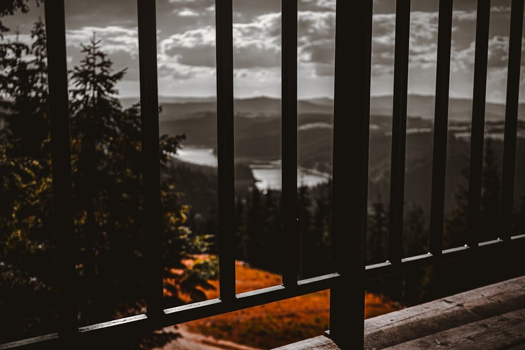
From Klingenstock, the route quickly delivers wide views over the Schwyz mountains, Lake Lucerne area, Muota Valley, and surrounding Alpine peaks. The trail follows the crest through a series of rises and dips. Some sections include substantial flights of steps, while narrow areas demand careful footing.
Pro Tip: Hike from Klingenstock toward Fronalpstock as recommended by Stoosbahnen. This direction also gives you a natural finish at Fronalpstock, where you can stop at the summit area before taking the chairlifts back toward Stoos village.
Hiking to Fronalpstock: The Finish and Easier Alternative

Fronalpstock is normally the finish of the full ridge hike rather than a separate eight-kilometre counterpart to Klingenstock. At 1,922 metres, the summit area provides broad views over Central Switzerland and has a mountain restaurant where you can take a longer break before descending.
If the full ridge is too exposed or demanding, Fronalpstock also has a much easier option. The official Fronalpstock Panorama Trail is a short, relatively flat summit walk. Stoosbahnen describes it as suitable for all-terrain pushchairs. This makes Fronalpstock a better option for families, less experienced walkers, or anyone uncomfortable with steep ridge exposure.
The distinction matters: reaching Fronalpstock by chairlift and walking around its summit is much easier than completing the Klingenstock-to-Fronalpstock mountain hiking trail.
Getting to Stoos Ridge: Transportation Options
| Transportation Option | How It Works |
| Train + bus via Schwyz | Take the train to Schwyz station, then bus 501 toward Muotathal Hölloch / Stoosbahn and get off at “Schwyz, Stoosbahn.” Continue to Stoos on the Schwyz-Stoos funicular. |
| Train + bus via Brunnen | Take the train to Brunnen, then bus 504 toward Morschach and get off at “Morschach, Luftseilbahn.” Continue by the Morschach-Stoos cable car. |
| Car | You cannot drive into car-free Stoos village. Park at the Schwyz-Stoos funicular valley station or at the Morschach-Stoos cable-car station, then continue by mountain railway. |
| Hiking from the valley | Longer walking approaches exist, but they add substantial ascent and are separate from the standard lift-assisted ridge outing. |
The official Stoos public-transport guide recommends Schwyz station and bus 501 for the funicular approach. A second option runs through Brunnen and Morschach.
The Schwyz-Stoos funicular reaches Stoos in about seven minutes. From its upper station, allow about 15 minutes to walk through Stoos village to the Klingenstock chairlift. The chairlift ride to Klingenstock takes about another 15 minutes. After finishing the ridge at Fronalpstock, the Fronalpstock chairlifts take about 20 minutes to descend, followed by roughly a 10-minute walk back to the upper station of the Schwyz-Stoos funicular.
Note: Stoos village is car-free. If you drive, your car stays at a valley station rather than at the trailhead.
2026 Lift Season and Operating Times
Lift schedules matter because the normal ridge-hike itinerary relies on the Klingenstock chairlift at the start and Fronalpstock chairlifts at the finish.
For the 2026 summer season, the Klingenstock chairlift is scheduled to operate daily from June 13 through October 11, 2026, and only in good weather. The Fronalpstock chairlifts have a longer scheduled summer season, with daily operation from May 1 through November 1, 2026.
These dates do not guarantee operation on the day you visit. Wind, thunderstorms, maintenance, or other mountain conditions can cause short-notice changes. Check the official operating information on the morning of your hike.
What to Bring for the Stoos Ridge Hike
Even though lifts shorten the approach, treat this as a mountain hike rather than a casual sightseeing walk. Your footwear should have reliable grip for gravel, stone steps, damp ground, and uneven trail surfaces.
- Hiking shoes or boots: Wear footwear with a stable sole and good traction.
- Water: Carry enough for the complete ridge section and adjust the amount for heat, your pace, and personal needs.
- Food: Bring snacks or a light meal so you are not dependent on reaching the summit restaurant at a particular time.
- Weather layer: Pack a light insulating layer and waterproof shell even when the valley forecast looks pleasant.
- Sun protection: Bring sunscreen, sunglasses, and a hat because much of the route is exposed.
- Navigation: A downloaded map or offline hiking map is useful even though the official trail is marked.
- Phone and power: Start with a charged phone and consider a small power bank if you will be taking many photographs or using GPS.
- Small first-aid kit: Blister treatment and basic wound care can be useful on the trail.
Trekking poles are optional. They can help on long stair sections and descents, although you should still keep a hand available where the path requires careful balance or use of a railing.
Tips for a Successful Hike: Safety and Preparation

Check both the weather and lift status before committing to the ridge. Mountain conditions can differ sharply from conditions in Schwyz, Brunnen, or Lucerne, and the Klingenstock lift is specifically operated only when conditions permit.
The ridge contains steep drops and exposed sections. SwitzerlandMobility states that hikers need sure-footedness and a head for heights. If someone in your group becomes uncomfortable with exposed terrain, the Fronalpstock Panorama Trail is a more appropriate alternative.
Warning: Do not remain on an exposed ridge during a thunderstorm. MeteoSwiss specifically advises avoiding exposed areas such as mountain ridges and peaks when thunderstorms threaten. Turn back or seek a safer route before lightning reaches the area.
Thunderstorm activity in Switzerland is highest during the warm summer months, particularly June through August. Check MeteoSwiss thunderstorm guidance and the local forecast before leaving.
Also consider your group’s pace. The official route times describe moving time under normal conditions. Photography, crowded trail sections, meals, children, and frequent stops can turn a two-hour ridge walk into a much longer outing.
Tell someone your intended route if you are hiking alone, keep to the marked mountain trail, and do not continue simply to meet a chairlift schedule if weather or trail conditions become unsafe.
Which Direction Should You Hike?
Stoosbahnen recommends the classic sequence of riding the Klingenstock chairlift first and then walking along the ridge to Fronalpstock. This direction creates a simple point-to-point outing and leaves the Fronalpstock summit facilities and chairlift descent at the end.
- Travel to Stoos village by the Schwyz-Stoos funicular or Morschach-Stoos cable car.
- Walk to the Klingenstock chairlift.
- Ride the Klingenstock chairlift to the summit area.
- Hike the ridge from Klingenstock toward Fronalpstock.
- Take a break at Fronalpstock and enjoy the summit viewpoints.
- Descend on the Fronalpstock chairlifts.
- Walk through Stoos village to your chosen mountain railway.
- Return to Schwyz or Morschach.
Pro Tip: Build extra time into the day rather than aiming for the final possible chairlift. A relaxed schedule gives you room for photographs, lunch, slower trail traffic, and unexpected weather changes.
Tickets for the Stoos Ridge Hike
The ridge trail itself does not require a hiking admission fee, but the standard itinerary uses several mountain railways. Stoosbahnen recommends its Peak Experience ticket for visitors doing the ridge hike because it covers the Schwyz-Stoos funicular, Morschach-Stoos cable car, Fronalpstock chairlifts, and Klingenstock chairlift during the ticket’s validity.
Ticket prices and discounts vary, so check the official Stoos shop before your visit instead of relying on an old price quoted in a travel article. Travelers using Swiss public-transport passes should also compare the available reductions before purchasing.
Best Time to Hike Stoos Ridge
The best day is a dry, stable day when the ridge is free of snow and the Klingenstock chairlift is operating. For 2026, its scheduled summer/autumn operation runs from June 13 through October 11, subject to good weather.
Clear mornings are especially valuable because the trail is exposed and summer thunderstorms often develop later in the day. Starting earlier also gives you more margin for breaks and avoids building your entire plan around the day’s final lift.
Do not assume that a warm day in Lucerne means ideal conditions on the ridge. Cloud, wind, rain, and temperature can be very different around 1,900 metres.
Exploring Stoos Ridge: Other Activities and Attractions
Stoos is useful even when the full ridge hike does not fit your ability or the weather. The Fronalpstock summit is accessible by chairlift and has a short panorama walk, viewpoints, a restaurant, and family-friendly facilities. That allows visitors to experience the high-mountain scenery without completing the exposed ridge traverse.
During winter, Stoos changes into a snow-sports destination with skiing, winter walking, and other snow activities. Winter routes should not be confused with the summer Klingenstock-Fronalpstock ridge trail, and seasonal signs and operating information should always be followed.
Stoos village itself has mountain restaurants and accommodation, while the wider area reflects the rural culture of Canton Schwyz. Depending on the restaurant and season, menus may include familiar Swiss mountain dishes. Check current menus and opening hours rather than assuming a particular dish will always be available.
Families who decide against the ridge can spend more time around Stoos village or ride to Fronalpstock for the easier panorama walk instead. This is a much better choice for young children or walkers who do not enjoy narrow, steep-sided trails.
Making the Most of Your Visit to Stoos Ridge
The most useful way to plan Stoos is to think of the day as a complete mountain-railway and hiking circuit rather than simply a four-kilometre walk. You must first reach the car-free village, walk to the Klingenstock lift, ride to the start, complete the ridge, descend from Fronalpstock, and return to your chosen valley station.
The classic Klingenstock-to-Fronalpstock route rewards capable hikers with extensive views over Lake Lucerne, the Muota Valley, and the mountains of Central Switzerland. Its relatively short distance should not hide the fact that it is an exposed mountain hiking trail with repeated stairs and steep terrain.
Choose a stable-weather day, confirm that the lifts are operating, wear proper footwear, carry water and weather protection, and allow more time than the minimum walking estimate. If the ridge does not suit your group, use the Fronalpstock chairlift and panorama walk for an easier high-altitude alternative.
Frequently Asked Questions
What is the Stoos Ridge hike?
The classic Stoos Ridge hike is the mountain trail between Klingenstock and Fronalpstock above Stoos in Canton Schwyz. SwitzerlandMobility lists the route at about 4 km with approximately 380 m ascent and 400 m descent. It offers extensive views over Lake Lucerne and the surrounding mountains.
How long does the Klingenstock-to-Fronalpstock hike take?
SwitzerlandMobility gives a route time of about 1 hour 50 minutes, while Stoosbahnen recommends allowing around 2 hours 30 minutes for the ridge. A full outing normally takes much longer once you include transport, village walks, chairlifts, viewpoints, meals, and breaks.
How do I get to Klingenstock and Fronalpstock?
First travel to car-free Stoos village. From Schwyz station, take bus 501 to “Schwyz, Stoosbahn” and ride the Schwyz-Stoos funicular. From Stoos, walk to the Klingenstock chairlift and ride to the start of the ridge. At Fronalpstock, chairlifts return you toward Stoos village.
Is the Stoos Ridge hike suitable for beginners?
It is not a good choice for someone who is uncomfortable with exposed mountain terrain. SwitzerlandMobility rates it as a medium mountain hiking trail and says hikers need sure-footedness and a head for heights. Less experienced visitors can ride to Fronalpstock and use its easier panorama walk instead.
Can children do the Stoos Ridge hike?
That depends on the child’s mountain-hiking experience, confidence with heights, stamina, weather, and the supervising adult’s judgment. The full ridge has exposed sections and is very different from a normal family walking path. For an easier family outing, consider the Fronalpstock Panorama Trail.
What is the best direction for the Stoos Ridge hike?
The official Stoos recommendation is to ride the Klingenstock chairlift and hike from Klingenstock to Fronalpstock. You can then rest at the Fronalpstock summit before descending by chairlift.
What is the best time of year to hike Stoos Ridge?
Choose a snow-free day during the Klingenstock chairlift’s summer/autumn operating season. In 2026, the lift is scheduled daily from June 13 through October 11, weather permitting. Always check current trail, weather, and lift information because mountain conditions can change quickly.
Can I drive directly to Stoos?
No. Stoos is a car-free mountain village. Drivers can park near the Schwyz-Stoos funicular valley station or the Morschach-Stoos cable-car station and continue by mountain railway.
Are there restaurants or facilities along the Stoos Ridge hike?
The Fronalpstock summit has a hotel and restaurant, and Stoos village has additional places to eat. Carry your own water and snacks for the ridge rather than depending entirely on a restaurant being open when you arrive.
Sources
- Stoosbahnen: Stoos Ridge Hike — official route direction, lift sequence, and approximate hiking time.
- SwitzerlandMobility: Gratweg Stoos, Route 827 — route distance, ascent, descent, trail classification, and exposure guidance.
- Stoosbahnen: Arrival by Public Transport — Schwyz bus 501 and Brunnen/Morschach bus 504 connections.
- Stoosbahnen: Klingenstock Chairlift Timetable — 2026 Klingenstock operating season and weather-dependent operation.
- Stoosbahnen: Fronalpstock Chairlifts — 2026 Fronalpstock operating period.
- MeteoSwiss: Thunderstorm Danger Levels — official lightning and exposed-ridge safety guidance.