The Eiger Trail is one of the classic mountain hikes in Switzerland’s Jungfrau Region, running beneath the Eiger’s famous north face from Eigergletscher toward Alpiglen. The route combines close-up mountain scenery, steep alpine terrain, scree, streams, and wide views over the Grindelwald valley. It is not a technical climb, but it is a real mountain hike that rewards good footwear, sure-footedness, and careful weather planning.
Quick Answer
The Eiger Trail is a roughly 6 km one-way mountain hike from Eigergletscher to Alpiglen. Allow about 2 hours of walking, plus stops. The standard downhill direction includes about 100 m of ascent and 820 m of descent. It suits experienced walkers with good fitness and sure-footedness, especially in dry conditions.
Key Takeaways
- The official route runs from Eigergletscher down to Alpiglen beneath the Eiger north face.
- Switzerland Tourism lists the route at 6 km, about 1 hour 55 minutes, with 100 m ascent and 820 m descent.
- Jungfrau Railways places the hike among routes for experienced walkers with good fitness and sure-footedness.
- For 2026, Jungfrau Railways lists the Eiger Trail season from June 20 to October 25, but weather or trail conditions can still cause closures.
- Check the latest trail status and MeteoSwiss weather hazards before setting out.
At a Glance
| Time Required | About 2 hours of walking; allow extra time for photos, breaks, and transport connections |
| Difficulty | Medium mountain hike; experienced walkers, good fitness, and sure-footedness recommended |
| Tools Needed | Sturdy hiking shoes or boots, layered clothing, waterproof shell, water, food, sun protection, and a small first-aid kit |
| Cost | No separate trail fee is normally required; budget for the mountain railway or gondola tickets used to reach and leave the trailheads |
Trail Overview and Difficulty
The Eiger rises to 3,967 meters in the Bernese Alps and has one of the best-known north faces in mountaineering. The Eiger Trail lets hikers experience that landscape without attempting a technical climb. The standard route begins at Eigergletscher station and follows the base of the north face before descending to Alpiglen.
According to Switzerland Tourism, the route is about 6 km long and takes roughly 1 hour 55 minutes in the downhill direction. It includes about 100 m of ascent and 820 m of descent. Jungfrau Railways describes the trail as running from Eigergletscher along the foot of the Eiger north face to Alpiglen, with steep alpine pastures, streams, and waterfalls along the way.
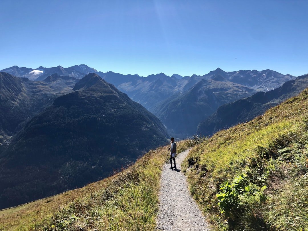
The path is marked, but the terrain is not uniformly easy. Expect gravel, rocky ground, scree, steep sections, and a long descent. Switzerland Tourism notes that difficult sections are secured with ropes. That does not turn the hike into a via ferrata, but it does mean you should be comfortable on mountain paths and uneven ground.
The standard route is short in distance but big in descent: about 6 km with roughly 820 m of downhill walking.
Which Direction Is Best?
Most hikers go from Eigergletscher to Alpiglen. This direction keeps the route mostly downhill and matches the usual description from Jungfrau Railways. Switzerland Tourism lists the reverse direction at about 2 hours 45 minutes, compared with about 1 hour 55 minutes in the standard direction, because hiking from Alpiglen to Eigergletscher requires much more climbing.
If your knees dislike long descents, the uphill direction may feel physically steadier even though it is harder on the lungs and legs. Trekking poles can help reduce strain on the descent, especially on loose or uneven ground.
Who Is the Eiger Trail Best For?
The Eiger Trail is better suited to hikers who already feel comfortable on mountain paths than to complete beginners. Jungfrau Railways groups it with hikes for experienced walkers and highlights the need for good fitness and sure-footedness. Fit older children with mountain-hiking experience may enjoy it, but it should not be treated as a simple stroller-friendly or beginner family walk.
Note: For a gentler alternative near the Eiger, the Jungfrau Eiger Walk is a shorter, well-developed route between Eigergletscher and Kleine Scheidegg that Jungfrau Railways describes as suitable for inexperienced hikers.
How to Get to the Eiger Trail
Getting to Eigergletscher
A convenient approach is through Grindelwald Terminal. The Jungfrau Railways arrival guide states that the Eiger Express runs from Grindelwald Terminal to Eigergletscher, where hikers can begin the trail. You can also reach the area by rail through Kleine Scheidegg, depending on your itinerary and the operating timetable.
Check the current timetable before your hike rather than relying on a remembered departure time. Mountain transport schedules can change by season and day.
Leaving From Alpiglen
The trail finishes at Alpiglen railway station. SwitzerlandMobility describes Alpiglen as the end of the Eiger Trail and notes a restaurant and railway station there. From Alpiglen, rail connections continue toward Grindelwald and Kleine Scheidegg, making the one-way hike practical without retracing the full route on foot.
Pro Tip: Build extra time into your day for transport, viewpoints, and photo stops. A two-hour trail can easily become a half-day outing once you include the ride to Eigergletscher and the return from Alpiglen.
What to Pack for the Hike
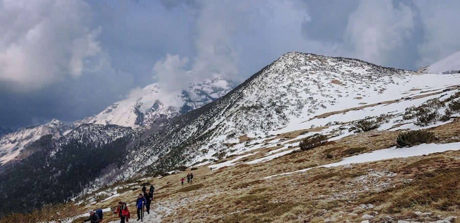
Good footwear matters on the Eiger Trail because the route includes uneven, rocky, and loose surfaces. Hiking shoes or boots with dependable grip are a better choice than smooth-soled casual footwear. Moisture-wicking socks can also reduce rubbing on a long descent.
Wear layers rather than relying on one heavy garment. Conditions at Eigergletscher can feel much cooler and windier than in Grindelwald. A moisture-wicking base layer, insulating layer, and waterproof or wind-resistant outer shell make it easier to adapt as conditions change.
Carry enough food and water for the hike. High-energy snacks such as nuts, energy bars, fruit, or sandwiches are easy to eat during breaks. Do not assume that every stream is a safe drinking-water source.
- Footwear: hiking shoes or boots with solid grip
- Clothing: layered clothing plus a waterproof shell
- Water: enough for the full hike and any transport delays
- Food: snacks or a light meal
- Sun protection: sunscreen, sunglasses, and a hat
- Safety: small first-aid kit and a charged phone
- Optional: trekking poles and binoculars
A camera or smartphone is useful because the trail provides changing views toward the Eiger, Grindelwald valley, Lauberhorn, Kleine Scheidegg, Wetterhorn, and Grosse Scheidegg.
Safety Tips and Precautions
Warning: Do not hike the Eiger Trail simply because the valley weather looks good. Mountain conditions can change quickly. Check the official trail status and MeteoSwiss hazard information before departure, and turn back if rain, snow, ice, thunderstorms, poor visibility, or unstable conditions make the route unsafe.
| Safety Step | Why It Matters |
|---|---|
| Check weather and trail status | Rain, snow, ice, wind, or thunderstorms can make steep and rocky sections more hazardous. |
| Wear grippy hiking footwear | The route includes scree, rock, and uneven mountain terrain. |
| Stay on the marked trail | Leaving the route can put you on steeper, looser, or more exposed ground. |
| Start with enough daylight | Photo stops and transport connections can make the day longer than the published walking time. |
| Respect your limits | A long descent can be tiring even when the total distance looks modest. |
| Give wildlife space | Observe animals quietly from a distance and do not feed them. |
Hiking with a companion can add a margin of safety, but it does not replace preparation. Tell someone your plan, keep your phone charged, and know your route before leaving the station. If the trail feels beyond your comfort level, choose an easier signed route instead.
Best Time to Hike the Eiger Trail
The practical hiking season depends on snow, trail conditions, and mountain transport. For 2026, Jungfrau Railways lists the Eiger Trail from June 20 through October 25. Switzerland Tourism gives July through October as the usual season for the route.
That does not mean every day in that window is suitable. Snow can linger early in the season, and autumn weather can bring fresh snow or icy ground. Summer can also bring storms. Always check the current route status and forecast close to the day of your hike.
July and August are popular because transport is running and the high trail is generally in summer condition, but those months can also be busier. Late June, September, and early October may feel quieter when conditions are favorable. Starting in the morning gives you more daylight and flexibility if you need to slow down or change plans.
Note: Published seasonal dates are planning guidance, not a guarantee that the trail is safe or open on a specific day. Local operating information and weather conditions should make the final decision.
Accommodation and Dining Options
Grindelwald is the most convenient base for many Eiger Trail hikers because it has direct access to Grindelwald Terminal and a broad range of hotels, guesthouses, hostels, apartments, restaurants, and shops. Staying in the village also makes it easier to buy food, check conditions, and reach the Eiger Express early in the day.
Dining is best planned around the trailheads and nearby transport hubs rather than assuming you will find several huts along the hiking path. Jungfrau Railways lists food and drink options around Eigergletscher, while SwitzerlandMobility notes a restaurant at Alpiglen. Opening hours can vary, so carrying your own water and snacks is still sensible.
After the hike, Grindelwald offers traditional Swiss dishes such as fondue, raclette, and rösti along with international choices. If you want a full meal, it is safer to plan it before or after the trail instead of depending on an unverified mid-route stop.
Wildlife and Scenery Along the Trail
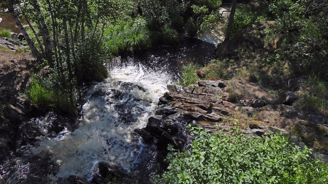
The main attraction is the mountain scenery. The path stays close to the Eiger north face, then opens to broad views toward the Grindelwald valley. Official route descriptions also highlight views toward Lauberhorn, Kleine Scheidegg, Wetterhorn, and Grosse Scheidegg, along with steep alpine pastures, streams, and waterfalls.
You may also see alpine wildlife such as marmots, chamois, or mountain birds, but sightings are never guaranteed. The best approach is to watch quietly from a distance rather than approaching animals for a photo. Binoculars are useful both for wildlife and for spotting climbers high on the Eiger wall when conditions are clear.
Summer alpine vegetation can add color to the route, while later in the season the landscape becomes more muted and autumnal. The scenery changes quickly with cloud, light, and weather, which is one reason the trail can feel different from one visit to the next.
Other Activities and Attractions in the Area
The Eiger Trail can be combined with other mountain experiences in the Jungfrau Region. If you want a shorter and easier walk, the Jungfrau Eiger Walk between Eigergletscher and Kleine Scheidegg is a good alternative. If you want a higher-altitude excursion, Jungfraujoch is accessible by the Jungfrau Railway from Eigergletscher, although that is a separate trip and should be planned around tickets, weather, and time.
Grindelwald also serves as a base for many other marked hiking routes and outdoor activities. Guided climbing, paragliding, and other mountain sports are available in the wider region through local operators, but their suitability depends on weather, experience, and operator requirements. For a lower-risk sightseeing day, mountain railways and viewpoints can deliver big scenery without adding another strenuous hike.
The area also has a deep mountaineering history connected to the Eiger north face. Rather than treating the mountain only as a photo backdrop, hikers can use the route as a chance to appreciate the scale of the wall and the long history of climbers who attempted it under far more demanding conditions.
If you’re planning a hike along the Eiger Trail, you might also be interested in something refreshing after a long day outside. Asian melons can be a light, hydrating snack when they are available. To learn more about varieties and flavors, see Exploring the Delightful World of Asian Melon.
Sources
- Jungfrau Railways: Eiger Trail – official route overview, direction, elevations, terrain, and endpoint.
- Switzerland Tourism: Eiger Trail – distance, duration, ascent, descent, difficulty, season, and route description.
- SwitzerlandMobility: Eiger Trail Route 353 – official hiking route reference and Alpiglen endpoint information.
- Jungfrau Railways: Hiking – 2026 operating season and experience-level guidance.
- Jungfrau Railways: Arriving – access via Grindelwald Terminal, Eiger Express, and Eigergletscher.
- MeteoSwiss: Weather Hazards – official Swiss weather warnings for thunderstorms, rain, snow, wind, and other hazards.
Frequently Asked Questions
What is the Eiger Trail?
The Eiger Trail is a marked mountain hiking route beneath the Eiger north face in Switzerland’s Bernese Oberland. The standard direction runs from Eigergletscher to Alpiglen.
Where is the Eiger Trail located?
It is in the Jungfrau Region of the Bernese Oberland, above Grindelwald. The hike starts at Eigergletscher station and ends at Alpiglen station in the standard downhill direction.
How long is the Eiger Trail?
Switzerland Tourism lists the Eiger Trail at about 6 km and around 1 hour 55 minutes from Eigergletscher to Alpiglen. Many hikers should allow longer for breaks and photos.
What is the difficulty level of the Eiger Trail?
The route has medium technical and physical requirements. Jungfrau Railways recommends it for experienced walkers with good fitness and sure-footedness. Expect rocky ground, scree, steep sections, and a long descent.
What are the highlights of the Eiger Trail?
Highlights include close views of the Eiger north face, alpine pastures, rocky terrain, streams and waterfalls, and views toward Grindelwald, Kleine Scheidegg, Lauberhorn, Wetterhorn, and Grosse Scheidegg.
Are there any facilities along the Eiger Trail?
Plan around the endpoints rather than expecting regular services on the trail. Eigergletscher has transport and dining facilities, while Alpiglen has a railway station and restaurant. Carry your own water and snacks.
When is the best time to hike the Eiger Trail?
The usual hiking season is summer into early autumn. For 2026, Jungfrau Railways lists the trail from June 20 to October 25. Conditions can still close the route, so check the latest trail status and weather before hiking.
Which direction should I hike the Eiger Trail?
Eigergletscher to Alpiglen is the standard and faster direction because it is mostly downhill. The reverse route is possible but takes longer and requires substantially more climbing.
Is the Eiger Trail suitable for beginners or families?
Complete beginners may find the route demanding because of the mountain terrain and long descent. Fit hikers and experienced older children may be comfortable on it. For an easier option, consider the shorter Jungfrau Eiger Walk between Eigergletscher and Kleine Scheidegg.