The Schynige Platte Panorama Trail is a compact mountain hike with broad views of Lake Thun, Lake Brienz, and the Eiger, Mönch, and Jungfrau. The route is short enough for a half-day outing, but it is not a flat sightseeing walk. You should be comfortable on uneven mountain paths, secured ridge sections, and roughly 340 metres of climbing.
Quick Answer
The official Schynige Platte Panoramaweg is a 6-kilometre circular mountain hike with about 340 metres of ascent and descent. Allow roughly 2 to 2.5 hours of walking, or about 3 hours with photo and rest stops. It is technically moderate and requires sturdy footwear, surefootedness, and suitable weather.
Key Takeaways
- The signed circular route starts and finishes at Schynige Platte railway station.
- Official route data lists about 6 kilometres, 340 metres of ascent and descent, and a walking time of 1 hour 55 minutes to about 2 hours 30 minutes.
- It is a medium mountain hiking trail, so expect rough ground, steeper sections, and an exposed or secured ridge in places.
- The main landmarks are the Daube or Tuba viewpoint, the ridge near Oberberghorn, the Loucherhorn area, Grätli, and the Oberberg huts.
- Check the railway timetable, trail status, and weather warnings on the day of your hike.
At a Glance
| Route | SwitzerlandMobility local route 345, Schynige Platte to Schynige Platte |
| Distance | About 6 km |
| Walking Time | About 1 hour 55 minutes to 2 hours 30 minutes, excluding long stops |
| Ascent and Descent | About 340 m up and 340 m down |
| Difficulty | Medium mountain hiking trail; easy fitness demand but moderate technical demand |
| Start and Finish | Schynige Platte railway summit station |
| Typical Season | June to October when the mountain route is snow-free and transport is operating |
| Cost | The trail is free; railway tickets, food, and other services cost extra |
Schynige Platte Panorama Trail Difficulty and Duration
The official SwitzerlandMobility route 345 is listed as a medium mountain hiking trail with an easy fitness requirement. It covers about 6 kilometres and gains and loses roughly 340 metres. SwitzerlandMobility gives a walking time of about 1 hour 55 minutes, while Jungfrau Railways suggests about 2 hours 30 minutes.
For practical planning, allow 2 to 2.5 hours of walking and closer to 3 hours if you expect photo stops, a snack break, or time at the viewpoints. Wet stones, fog, crowds, or a slower group can add more time.
The route does not require ropes, climbing equipment, or mountaineering skills in normal summer conditions. However, mountain hiking trails can include narrow, rough, steep, and exposed sections. You should have secure footing, a reasonable head for heights, and shoes with a firm tread.
Note: Published hiking times normally describe moving time, not the full outing. Add time for the train ride, meals, the Alpine Garden, photography, and waiting for the return service.
Route Overview and Main Waypoints
The circular hike begins near the mountain restaurant above Schynige Platte summit station. Follow the signs for the Panoramaweg and route 345 rather than relying only on a general place name in a phone app.
- Schynige Platte station to Daube or Tuba: Begin near the summit station and climb toward the first major viewpoint. This section opens views over Lake Thun, Lake Brienz, and the Bernese Alps.
- Ridge near Oberberghorn: Continue along the well-marked mountain path and secured ridge section around Oberberghorn. Slow down where the trail narrows or the ground is loose.
- Toward the Loucherhorn area: The circular route continues in the direction of Loucherhorn. Some maps show an optional detour, so follow the signed route that matches your ability and available time.
- Turn at Grätli: At the Grätli signpost, turn right and begin the return section.
- Oberberg huts to Schynige Platte: Pass the mountain huts at Oberberg and follow the path back to the station and hotel area.
Pro Tip: Save an offline map of route 345 before boarding the train. The trail is signed, but an offline route helps you confirm the turn at Grätli and avoid drifting onto longer connecting hikes.
Scenic Views and Points of Interest
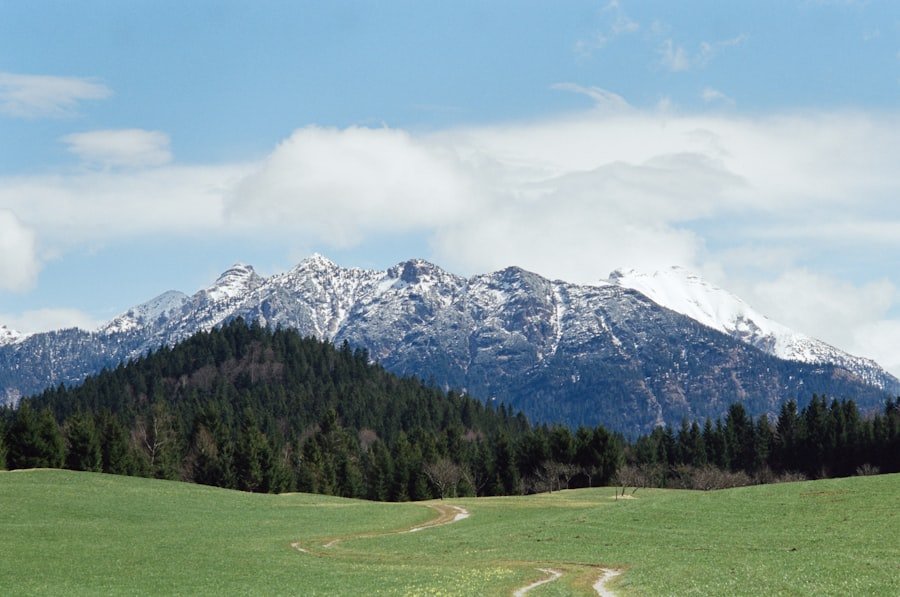
The scenery changes throughout the loop. From the Daube or Tuba viewpoint and the ridge, you can look toward Lake Thun, Lake Brienz, and the Bernese Alps. On a clear day, the Eiger, Mönch, and Jungfrau form the most recognisable part of the skyline.
Few short hikes in the Jungfrau Region combine two lake views, a secured ridge, alpine meadows, and the Eiger–Mönch–Jungfrau panorama in one circular route.
The trail also crosses alpine meadows and limestone terrain. Flowers vary by month and weather. The nearby Schynige Platte Botanical Alpine Garden displays around 800 plant species native to the Swiss Alps, making it a useful addition if you want to learn what grows above the tree line.
The original place name sometimes written as “Louchersee” should be understood as Loucherhorn, a mountain landmark in the wider route area. The standard Panoramaweg does not use a lake called Louchersee as a principal waypoint.
Trail Conditions, Markings, and Terrain
| Section | Typical Surface | Main Consideration |
|---|---|---|
| Station to Daube or Tuba | Mountain path, grass, gravel, and stone | Steady climbing and sun exposure |
| Oberberghorn ridge area | Rocky and partly secured ridge trail | Surefootedness and comfort with exposure |
| Grätli and Oberberg return | Mixed alpine path and pasture terrain | Loose or slippery ground after rain |
| Early or late season | Possible mud, old snow, ice, or closed sections | Check current route status before starting |
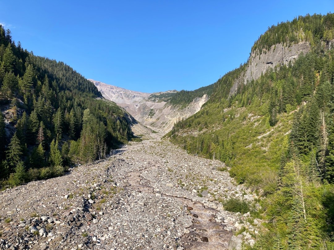
Mountain hiking trails in Switzerland are commonly marked white-red-white. This category can involve rough, steep, narrow, or exposed ground and calls for solid boots, suitable clothing, a map, surefootedness, and awareness of mountain hazards.
Do not judge the trail only by its short distance. Rain can make polished rocks and soil slippery, while fog can hide junctions and remove the visual reference points that make the route easy to follow in clear weather.
Warning: Do not continue onto the ridge during a thunderstorm, dense fog, snow, ice, or strong wind. MeteoSwiss advises avoiding mountain ridges and other exposed terrain when lightning is possible.
What to Bring for the Hike
Pack for a mountain route rather than a casual park walk. Conditions near 2,000 metres can feel much cooler and windier than Wilderswil or Interlaken, even on a warm day.
- Hiking shoes or boots with a firm, non-slip sole
- Water and energy-rich snacks
- Warm layer plus a waterproof or windproof shell
- Sunscreen, sunglasses, and a hat
- Offline route, paper map, or GPS device with a charged battery
- Small first-aid kit and any personal medication
- Trekking poles if they improve your balance on descents
There is food service around the station and mountain hotel during operating periods, but you should still carry your own water and enough food to finish the walk if a service is closed or crowded.
Wildlife and Alpine Flora
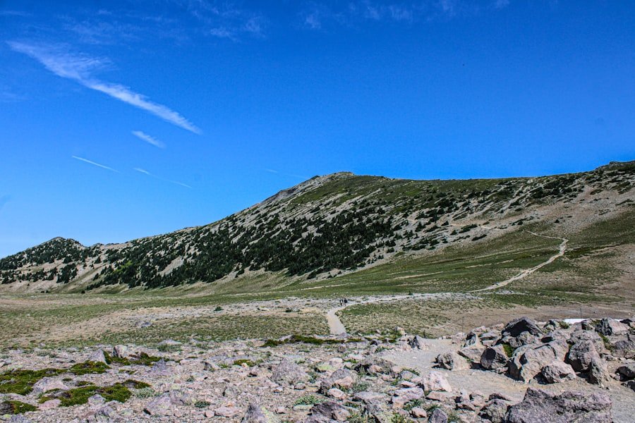
SwitzerlandMobility specifically notes marmot colonies and abundant alpine flowers along the route. Alpine roses grow in parts of the ridge area, while the flower display changes through the season.
You may also see chamois or alpine birds in the wider Schynige Platte area, but sightings are never guaranteed. Move quietly, watch from a distance, and never feed wildlife.
Stay on the marked path, especially through flower-rich meadows. Alpine plants grow slowly, and repeated trampling can damage fragile ground. Carry all food scraps and rubbish back to the station.
Safety Tips for the Schynige Platte Panorama Trail
- Check three things before boarding: the day’s railway timetable, the trail’s operating status, and the MeteoSwiss forecast and hazard map.
- Tell someone your plan: share the route, start time, and expected return time.
- Stay on the signed mountain path: shortcuts can damage vegetation and lead onto steeper ground.
- Turn around early: do not wait for fog, wind, rain, or fatigue to become an emergency.
- Keep enough phone battery: cold, navigation, and photography can drain it faster than expected.
- Know the rescue contact: Swiss Air-Rescue Rega can be reached at 1414 within Switzerland when mobile coverage is available.
If lightning is nearby and you cannot reach a substantial shelter, leave exposed ridges and summits as quickly and safely as possible. Do not shelter under an isolated tree or remain beside metal railings, towers, or other prominent objects.
How to Reach the Trail and Plan the Return
Travel to Wilderswil by train or car, then take the historic Schynige Platte cogwheel railway to the summit station. Jungfrau Railways lists the mountain journey at approximately one hour. The train ride is part of the experience, but it also sets the limits for your hiking day.
For the 2026 season, the official Panorama hike and Schynige Platte services are listed from June 13 to October 25, 2026. Dates, departure times, and operating conditions can change, so confirm the current Schynige Platte operating information before travelling.
Food and drink are normally available at the mountain hotel and bistro during operating periods. The Botanical Alpine Garden is also near the station; its published 2026 opening dates are June 13 to October 25, from 08:00 to 18:00.
Note: Check the last downhill train before you start walking. Do not plan to reach the station at the exact departure time; leave a useful buffer for slow terrain, photos, and unexpected delays.
Frequently Asked Questions
How difficult is the Schynige Platte Panorama Trail?
It is a medium mountain hiking trail. The fitness demand is modest for a mountain route, but the rough ground, climbing, and secured ridge sections require surefootedness, suitable shoes, and comfort with some exposure.
How long does the Schynige Platte Panorama Trail take?
Official estimates range from about 1 hour 55 minutes to 2 hours 30 minutes of walking. Allow around 3 hours if you want relaxed photo, snack, and viewpoint stops.
How long and steep is the route?
The official circular route is about 6 kilometres with roughly 340 metres of ascent and 340 metres of descent. Short optional detours can change your final distance and time.
Can beginners hike the Panorama Trail?
A fit beginner can consider it in dry, clear conditions if they are comfortable on uneven mountain paths and exposed sections. It is not the best choice for someone who is unsteady, strongly afraid of heights, or wearing casual shoes.
Is the trail suitable for children?
Older children with mountain hiking experience may manage the route with close adult supervision. The trail is not stroller-friendly, and adults should keep children close on narrow or exposed sections. Choose a shorter attraction near the station when footing or weather is poor.
When is the best time to hike?
The normal season is June to October, depending on snow, trail status, and railway operations. Mid-summer often gives the best chance of a snow-free path, but the daily weather and hazard forecast matter more than the calendar.
Do you need trekking poles?
Poles are optional. They can improve balance and reduce strain on descents, but they do not replace secure footing or proper footwear. Keep one hand free where you need to use a railing or cable.
The Schynige Platte Panorama Trail offers an unusually varied half-day hike, but its short distance should not hide the mountain-trail demands. Plan around the 6-kilometre circular route, allow enough time for stops, and treat wet rock, fog, wind, and thunderstorms as reasons to shorten or cancel the hike.
Before leaving Wilderswil, verify the railway timetable, current route status, and MeteoSwiss warnings. With sturdy shoes, layers, water, and a clear turnaround plan, you can enjoy the lakes, ridge, alpine flowers, and classic Bernese Oberland skyline with much more confidence.
Sources
- SwitzerlandMobility: Panoramaweg Schynige Platte, route 345 — distance, ascent, descent, time, difficulty, and route description.
- Jungfrau Railways: Panorama hike Schynige Platte — official walking-time estimate, seasonal status, and waypoints.
- Jungfrau Railways: Schynige Platte visitor information — railway access, attractions, restaurants, and 2026 operating season.
- SwitzerlandMobility: Grades of difficulty for hiking routes — mountain-trail requirements, terrain, and equipment.
- MeteoSwiss: Thunderstorm safety — official advice for ridges, exposed terrain, and lightning.
- Schynige Platte Botanical Alpine Garden — 2026 opening dates, hours, and weather reminder.