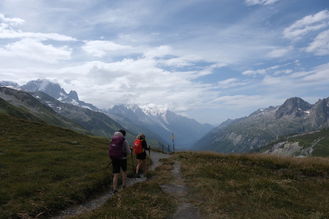
The Aletsch Glacier area in Switzerland offers some of the most memorable high-altitude hiking in the Alps, with routes overlooking the Great Aletsch Glacier, mountain lakes, ancient stone-pine forest, and peaks above 4,000 metres. There is not one single fixed “Aletsch Glacier Trail.” Instead, hikers can choose from several marked routes around Riederalp, Bettmeralp, Fiescheralp, Moosfluh, Bettmerhorn, Eggishorn, and Märjelensee.
Quick Answer
Aletsch Glacier hikes range from easy walks of a few hours to demanding routes of more than 20 km. Popular choices include the 9.3 km Riederalp-to-Bettmerhorn hike, the 12.2 km Eggishorn-to-Fiescheralp route, and the 14.6 km Bettmerhorn-Märjelensee circuit. Check weather, trail status, and cable-car times before leaving.
Key Takeaways
- The Great Aletsch Glacier is the largest glacier in the Alps and lies within the Swiss Alps Jungfrau-Aletsch UNESCO World Heritage Site.
- There is no single fixed Aletsch Glacier Trail. Official hikes vary greatly in distance, elevation gain, and difficulty.
- Bettmerhorn, Eggishorn, Moosfluh, and Hohfluh are major viewpoints overlooking the glacier.
- Normal hiking routes stay on marked mountain paths. Do not step onto glacier ice unless you are on a properly equipped guided glacier tour.
- Riederalp, Bettmeralp, and Fiescheralp are car-free, so most hikes involve cable-car or gondola access.
- Check the official trail status, lift timetable, and MeteoSwiss forecast immediately before your hike.
At a Glance
| Time Required | About 1 hour 40 minutes to more than 6 hours, depending on the route |
| Difficulty | Easy to difficult; choose the specific route according to your fitness and mountain-hiking experience |
| Tools Needed | Hiking footwear, layered clothing, rain and sun protection, water, food, map or offline navigation, charged phone, and first-aid supplies |
| Cost | No separate fee for using normal hiking paths, but most itineraries require train, cable-car, gondola, parking, food, or accommodation expenses. Lift fares vary by route and ticket type. |
The Great Aletsch Glacier is about 20 km long today, and its retreat means older distance figures found in guidebooks and online articles may no longer describe its current length accurately.
Planning Your Aletsch Glacier Hike
Planning starts with choosing a specific route rather than simply searching for “the Aletsch Glacier Trail.” The official Aletsch Arena hiking portal lists a large network of marked trails, including short plateau walks, glacier-view hikes, long mountain circuits, and more technical alpine routes.
Consider four things before choosing: walking time, total ascent and descent, the highest altitude, and the difficulty rating. A 10 km mountain hike with hundreds of metres of climbing can require far more effort than a longer level walk.
Warning: A normal Aletsch hiking route is not a glacier crossing. Stay on marked trails and do not walk onto the glacier, approach crevasses, or enter ice caves independently. Visitors who want to travel on glacier ice should use an appropriately qualified guide and the required glacier equipment.
Check Trail and Lift Status
Mountain routes can close because of snow, storms, maintenance, rockfall, or other local conditions. Cable-car operating periods also change through the year. Before leaving your accommodation, check the official Aletsch Arena summer status report and confirm the lifts needed for your route are running.
Pro Tip: Work backward from the last cable car or gondola you need to catch. Add extra time for photo stops, lunch, fatigue, and unexpected trail delays instead of planning to arrive at the station at the final minute.
Best Time to Hike
Summer through early autumn is the main period for the higher hiking routes, but exact conditions vary from year to year. Snow can remain on high paths after lower trails have cleared, and early snow can affect routes again in autumn. Do not use the calendar alone to decide whether a trail is safe.
Check the MeteoSwiss forecast and hazard information before setting out. Mountain weather can change quickly, and thunderstorms, wind, cold, rain, or snow can make an otherwise manageable trail unsafe.
Getting to the Trail Area
Riederalp, Bettmeralp, and Fiescheralp are car-free mountain destinations. Visitors travel to valley stations such as Mörel-Filet, Bettmeralp valley station, or Fiesch and continue uphill by cable car or gondola.
For example, hikers using an Eggishorn route can travel by train to Fiesch, walk to the Fiesch-Eggishorn valley station, and take the lifts toward Fiescheralp and Eggishorn. Riederalp routes are commonly accessed from Mörel-Filet.
If you are driving, leave the car in an authorized valley parking area rather than expecting to drive to the high mountain villages. Check the Aletsch Arena travel and mobility information for current access details.
What to Pack for the Aletsch Glacier Trail
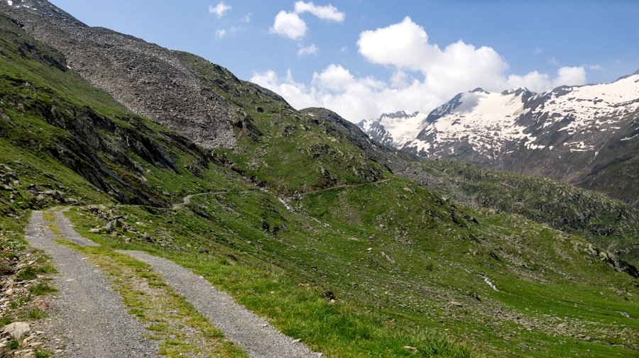
Proper equipment matters because many Aletsch routes travel over rocky mountain paths at elevations above 2,000 m. Wear hiking shoes or boots with a secure, grippy sole. Ankle-supporting footwear can be useful on longer routes or uneven terrain.
Use layers rather than relying on one heavy garment. Conditions can feel warm in direct sun and much colder when clouds, wind, or rain arrive.
- Water: Carry enough for your planned route instead of assuming every refreshment stop will be open.
- Food: Bring snacks or a packed meal, especially on longer circuits.
- Weather protection: Pack a waterproof outer layer and an insulating layer.
- Sun protection: Bring sunscreen, sunglasses, and a hat. UV exposure is stronger at altitude and can also reflect from snow and ice.
- Navigation: Carry a map or downloaded offline route, even on a marked trail.
- Phone: Start with a fully charged phone. A small power bank can help on long days.
- First aid: Carry basic first-aid supplies and any personal medication you may need.
- Emergency protection: A lightweight emergency blanket is a useful addition to a mountain-hiking kit.
The Swiss Alpine Club hiking-safety guidance also recommends suitable footwear, weather protection, first-aid supplies, and careful route planning.
The Best Aletsch Glacier Hiking Routes and Highlights
The best route depends on how much time you have, your fitness, and whether you prefer an easier panoramic walk or a longer mountain day. The following figures come from official Aletsch Arena route listings. Conditions can change, so verify the route again immediately before hiking.
| Route | Distance | Time | Ascent / Descent | Official Difficulty |
|---|---|---|---|---|
| Fiescheralp to Riederalp via Herrenweg and Aletschpromenade | 7.9 km | 2:30 | 53 m / 343 m | Easy |
| Riederalp via Moraine Trail to Bettmerhorn | 9.3 km | 3:30 | 742 m / 87 m | Moderate |
| Eggishorn via Märjelensee to Fiescheralp | 12.2 km | 3:45 | 131 m / 784 m | Moderate |
| Bettmerhorn via Märjelensee to Bettmeralp | 14.6 km | 5:30 | 486 m / 1,142 m | Difficult / T2 |
| Moosfluh via Märjelensee to Riederalp | 23.2 km | 6:15 | 1,167 m / 1,191 m | Difficult / T2 |
Riederalp to Bettmerhorn via the Moraine Trail
This 9.3 km route climbs from Riederalp toward Riederfurka and follows terrain shaped by former glacier margins before reaching Bettmerhorn. The official route lists about 742 m of ascent and a walking time of roughly 3 hours 30 minutes.
It is a good choice for hikers who want a substantial mountain walk and wide glacier views without committing to one of the longest Märjelensee circuits. See the official Riederalp-Bettmerhorn route.
Eggishorn via Märjelensee to Fiescheralp
This 12.2 km route begins near the Eggishorn mountain station and descends through high mountain terrain toward Tällisee, the Gletscherstube area, and Märjelensee before returning toward Fiescheralp. The official route lists approximately 3 hours 45 minutes of walking, 131 m of ascent, and 784 m of descent.
Because it starts high, the route delivers glacier and mountain views quickly, but hikers still need secure footing and suitable mountain-hiking equipment. See the official Eggishorn-Märjelensee route.
Bettmerhorn via Märjelensee to Bettmeralp
This 14.6 km hike is one of the stronger full-day options. It starts at the Bettmerhorn viewpoint at about 2,647 m and follows mountain paths toward Roti Chumma, Märjelensee, and the Gletscherstube area before returning to the sunny plateau and Bettmeralp.
The official listing rates it difficult/T2 and gives a walking time of about 5 hours 30 minutes, with 486 m of climbing and more than 1,100 m of descent. See the official Bettmerhorn-Märjelensee route.
Moosfluh via Märjelensee to Riederalp
Hikers looking for a longer endurance challenge can consider the 23.2 km route from Moosfluh through the glacier-side landscape toward Märjelensee and back across the plateau to Riederalp.
The official figures are about 6 hours 15 minutes, 1,167 m of ascent, and 1,191 m of descent. This is the 23 km route that should not be confused with every other Aletsch Glacier hike. See the official Moosfluh-Märjelensee route.
An Easier Plateau Option
If a long mountain circuit is more than you want, the Fiescheralp-to-Riederalp route via Herrenweg and the Aletschpromenade is officially listed as easy. It covers about 7.9 km in roughly 2 hours 30 minutes, with relatively little climbing.
This type of route is more suitable for visitors who want mountain scenery without the demands of the longer T2 hikes, although weather, altitude, and individual fitness still matter.
Safety Precautions and Guidelines
Mountain hiking requires more preparation than an ordinary park walk. Stay on marked routes and obey temporary closures and local signs. Loose stones, wet rock, exposed sections, residual snow, and sudden weather changes can increase the risk of falls.
Do not assume that a route is safe simply because it was open on a previous visit or appears clear from a cable-car station. Check current conditions before starting and be willing to turn back if conditions deteriorate.
Warning: If thunderstorms are forecast or you hear thunder while high on an exposed ridge, leave exposed viewpoints and ridgelines as conditions allow. MeteoSwiss advises avoiding exposed peaks, ridges, open terrain, isolated trees, and bodies of water during lightning danger.
Emergency Numbers
For mountain rescue in Switzerland, the Swiss Alpine Club lists REGA 1414 and the European emergency number 112. Save these numbers before the hike, but remember that phone coverage cannot be guaranteed everywhere in mountain terrain.
Altitude Awareness
Some Aletsch viewpoints and trail sections are around or above 2,500 m. Visitors arriving directly from much lower elevations may notice headache, unusual fatigue, nausea, or dizziness. Slow down, stay hydrated, and do not continue climbing if symptoms become significant or worsen.
People with relevant heart, lung, or other medical conditions should seek individualized medical advice before strenuous high-altitude activity.
Hiking Alone
If you hike alone, tell someone your planned route, starting point, destination, and expected return time. Carry navigation that works offline and avoid changing to a more difficult route without updating your plan.
Wildlife and Flora Along the Trail
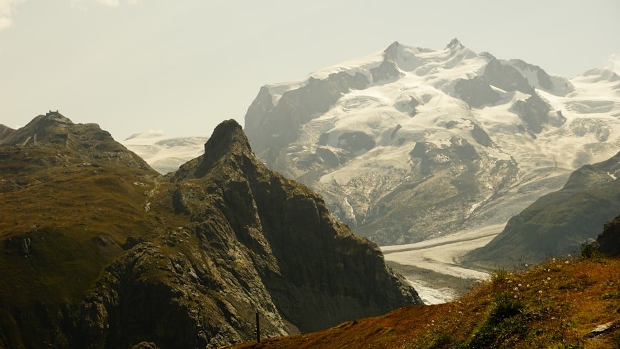
The Aletsch region contains a mix of high alpine terrain, meadows, rocky slopes, and protected forest habitat. Depending on the location, season, and luck, hikers may see alpine wildlife such as marmots or mountain ungulates from a distance.
Wildflowers add color to the meadows during the growing season, while the Aletsch Forest is known for its old Swiss stone pines. The forest and surrounding habitats form part of an environmentally sensitive landscape next to the glacier.
Note: Observe wildlife quietly from a distance. Do not feed animals, pick protected plants, or leave the marked trail simply to get a closer photograph.
The Aletsch Forest information from Aletsch Arena provides more background on this distinctive landscape and its hiking routes.
Camping and Accommodation Options
Riederalp, Bettmeralp, Fiescheralp, and the surrounding valley communities offer hotels, holiday apartments, chalets, guest accommodation, and other authorized places to stay. Spending a night in the region can make a long hiking itinerary easier because you do not need to combine every mountain route with a long journey to and from another part of Switzerland on the same day.
Do not assume that wild camping beside a hiking trail is permitted. Aletsch Arena states that bivouacking and wild camping are generally not allowed in the destination for safety and environmental reasons. Wild camping is prohibited in nature reserves, wildlife protection areas, hunting areas, and locations covered by access restrictions.
Note: If you want to camp, use an authorized campsite or other legal accommodation and verify the current local rules before your trip. Do not treat emergency bivouacking as ordinary recreational camping.
Mountain restaurants and refreshment stops exist on or near several popular routes, but opening days and hours can change. Carry enough water and food to complete the hike safely even if your planned restaurant is closed.
Tips for Responsible Hiking and Environmental Conservation
The Great Aletsch Glacier and its surrounding landscapes are environmentally sensitive. UNESCO recognizes the Swiss Alps Jungfrau-Aletsch area for its exceptional glacial landscape, geological processes, and alpine habitats. You can help protect the area by keeping your impact small.
- Stay on established hiking paths.
- Carry all rubbish out with you.
- Do not carve, move, or damage natural features.
- Keep a respectful distance from wildlife.
- Do not pick wildflowers or damage alpine vegetation.
- Use toilets where provided rather than contaminating water or heavily visited areas.
- Respect signs, seasonal restrictions, grazing livestock, and closed routes.
- Avoid entering glacier ice, unstable moraines, or other hazardous terrain outside the marked route.
The glacier itself is also an important indicator of climate change. Glacier Monitoring in Switzerland conducts long-term observations of glaciers including the Great Aletsch Glacier, while the changing glacier margin continues to reshape the surrounding landscape.
Frequently Asked Questions
What is the Aletsch Glacier Trail?
The name is commonly used for hiking routes overlooking the Great Aletsch Glacier in the Aletsch Arena. There is no single official trail with one fixed distance. Routes start from places such as Riederalp, Bettmeralp, Fiescheralp, Moosfluh, Bettmerhorn, and Eggishorn.
How long is the Aletsch Glacier Trail?
It depends on the route. Examples include 7.9 km from Fiescheralp to Riederalp, 9.3 km from Riederalp to Bettmerhorn, 12.2 km from Eggishorn via Märjelensee to Fiescheralp, 14.6 km from Bettmerhorn via Märjelensee to Bettmeralp, and 23.2 km from Moosfluh via Märjelensee to Riederalp.
What is the difficulty level of Aletsch Glacier hikes?
Difficulty ranges from easy plateau walks to demanding mountain hikes. The Bettmerhorn-Märjelensee-Bettmeralp and Moosfluh-Märjelensee-Riederalp routes are officially rated difficult/T2, while some plateau routes are rated easy. Always use the rating for the exact route you plan to hike.
Do Aletsch hiking trails go onto the glacier?
The normal marked hiking routes described in this guide provide views of the glacier but should not be treated as glacier crossings. Do not step onto glacier ice independently. Guided glacier tours use specialized equipment and professional guidance because crevasses and other glacier hazards may not be obvious.
What are some highlights of the Aletsch Glacier hiking area?
Highlights include views from Moosfluh, Bettmerhorn, Eggishorn, and Hohfluh, the Märjelensee area, the Aletsch Forest, glacier-shaped terrain, mountain lakes, and wide views across the Valais Alps.
Are there restaurants and facilities along the routes?
Several popular routes pass mountain restaurants, villages, lift stations, or other facilities, but availability depends on the exact route and season. Do not rely on a restaurant as your only source of water or food. Confirm opening times before leaving.
What should hikers bring for an Aletsch Glacier hike?
Bring sturdy hiking footwear, water, food, layered clothing, waterproof protection, sunscreen, sunglasses, a hat, navigation, a charged phone, and basic first-aid supplies. Longer or more exposed routes require greater preparation.
Can I camp beside the Aletsch Glacier Trail?
Do not assume so. Aletsch Arena states that wild camping and bivouacking are generally not permitted, and wild camping is prohibited in protected and restricted areas. Use authorized accommodation or a legal campsite and verify local rules before your visit.
How do I reach Aletsch Glacier hiking routes?
Most visitors travel by train or car to a valley station and continue by cable car or gondola. Riederalp, Bettmeralp, and Fiescheralp are car-free. Common valley access points include Mörel-Filet, Bettmeralp valley station, and Fiesch.
Sources
- Aletsch Arena Hiking — official hiking network, viewpoints, and route-planning information.
- Aletsch Arena: Bettmerhorn via Märjelensee to Bettmeralp — official distance, duration, elevation, difficulty, and route description.
- Aletsch Arena Summer Status Report — current hiking-route and lift operating status.
- Swiss Alpine Club: Safety When Hiking — route planning, equipment, weather, footwear, and emergency guidance.
- MeteoSwiss — official Swiss mountain weather forecasts and hazard warnings.
- UNESCO: Swiss Alps Jungfrau-Aletsch — World Heritage status, glacier landscape, geology, and ecological significance.