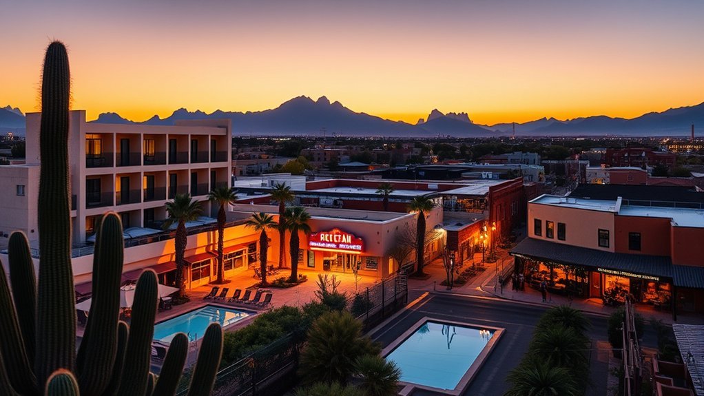
Picking a hike near Tempe can feel tricky because the best choice changes with your time, fitness, heat tolerance, and view goals. Some routes give you easy desert scenery in under an hour, while others demand steep climbs and early starts. Use this guide to compare the best nearby trails, know what to expect, and choose a route that fits your day.
What’s in This Article
- Papago Park: Hole-in-the-Rock and Easy Scenic Loops
- South Mountain Park: Dobbins Lookout and National Trail Options
- Camelback Mountain: Cholla and Echo Canyon Routes
- Usery Mountain Regional Park: Wind Cave and Pass Mountain Trails
- Piestewa Peak: Summit Trail and Foothill Access
- White Tank Mountain Regional Park: Waterfall Trail and Mesquite Loop
- Rio Salado Pathways and Tempe Town Lake Riverside Walk
- How to Choose the Right Tempe-Area Hike
- Desert Hiking Safety Near Tempe
- Frequently Asked Questions
Quick Answer
The best hikes near Tempe range from easy walks at Papago Park and Tempe Town Lake to hard climbs on Camelback Mountain and Piestewa Peak. Choose Papago or Rio Salado for a relaxed outing, South Mountain for broad skyline views, and Camelback or Piestewa for a tough summit workout.
Key Takeaways
- Pick Papago Park or Tempe Town Lake when you want an easy, scenic route close to Tempe.
- Choose Camelback Mountain or Piestewa Peak only when you feel ready for steep, exposed climbs.
- Start early, carry more water than you think you need, and avoid hiking during peak heat.
- Check each park’s trail rules before bringing dogs, bikes, or strollers.
- Use shaded paths, paved routes, or shorter loops when hiking with kids or newer hikers.
Papago Park: Hole-in-the-Rock and Easy Scenic Loops
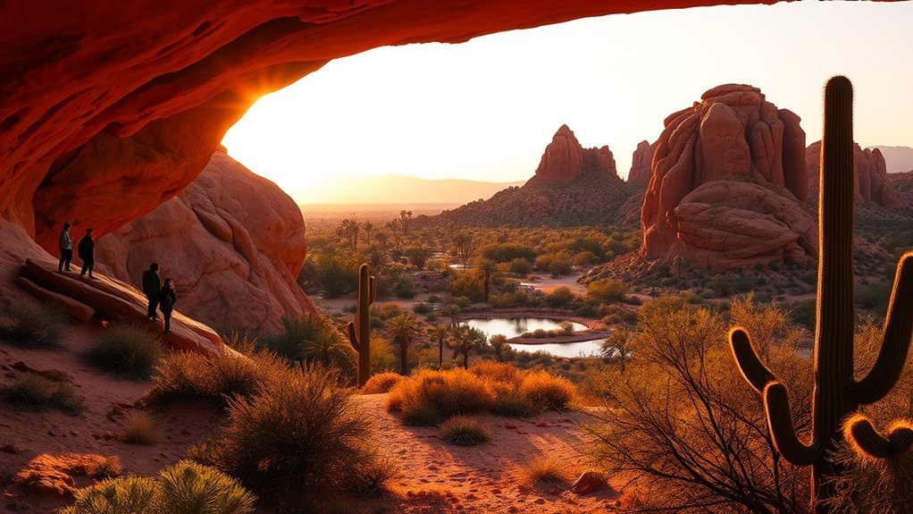
Start your Papago Park visit at the iconic Hole-in-the-Rock, an easy climb with big views for the effort. From the lookout, you’ll see Tempe, the Phoenix skyline, and nearby desert ridges.
Short, marked loops wind through red sandstone buttes, desert wildflowers, and scattered saguaro silhouettes. Trails like the Double Butte Loop and the Park Trail use mostly flat, compacted dirt and rock, so sturdy shoes work well for most visitors.
Interpretive signs explain local geology and native plants along the way. Early morning and late afternoon bring softer light and cooler air, while weekends draw larger crowds.
You can picnic in shaded ramadas or take photos from several angles. Papago’s compact loops make it one of the best half-day hikes near Tempe.
Products Worth Considering

【WATERPROOF PERFORMANCE】Built with the OUTJET-Tex advanced waterproof membrane, these men’s hiking shoes keep your feet dry and comfortable in rain, puddles, or wet trails—blocking water while maintaining breathability for all-day wear

COMFORT AND FIT: These waterproof hiking shoes feature a padded collar for no-rub comfort, flex notches that cradle the ankle and allow natural foot movement, a rubber outsole for excellent traction, and a EVA midsole for compression and rebound that keeps you comfortable and supported on the trail all day long

Waterproof: This men's hiking Shoes Featuring a waterproof membrane construction, incorporate an integrated tongue-and-upper design to prevent water ingress at the tongue seam. This ensures all-day dry comfort even in damp conditions.
South Mountain Park: Dobbins Lookout and National Trail Options
Perched above the city, Dobbins Lookout gives you one of the most dramatic panoramas in the Valley of the Sun. You can see downtown Phoenix, Tempe, and the Salt River basin from the paved overlook.
After the view, choose from National Trail routes that cross rocky ridges and desert washes. Trail options range from short scenic walks to steady climbs with open skyline views.
- Mormon Loop: Choose this moderate loop for rolling climbs and seasonal wildflower views.
- National Trail: Use these longer connector segments to reach quieter ridgelines and lookout points.
- Dixie Mountain: Pick this steeper option for wide skyline views without technical scrambling.
Bring water, sun protection, and shoes with good grip. Early starts help you avoid heat and give you better light for photos.
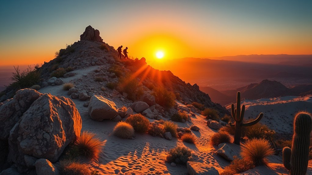
Camelback Mountain: Cholla and Echo Canyon Routes
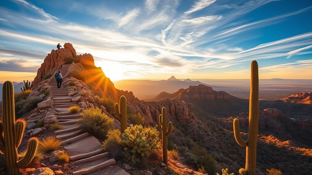
Climb Camelback when you want a hard, iconic hike with sweeping valley views. Echo Canyon gives you the steeper, more direct scramble, while Cholla follows a longer ridge with sustained elevation gain.
You’ll meet steep switchbacks, rock steps, and sections where metal rails help with balance. Echo Canyon gains elevation fast, so expect short, intense sections that require sure footing.
Cholla feels longer but spreads out the climb. Both trails end at a rocky summit with panoramic views of Tempe, Phoenix, and distant mountains.
Warning: Camelback has steep, exposed sections, so skip it during extreme heat or when you lack enough water.
Start early, wear sturdy shoes, and carry plenty of water. Sunrise and sunset can look spectacular, but those times also bring crowds.
Products Worth Considering

Suede leather and breathable mesh upper

Size Matters And We Mean It! Watch our simple measuring guide video to ensure maximum comfort. Taking 1 minute now ensures an optimal & comfortable fit later!
Pigskin leather and mesh upper

Usery Mountain Regional Park: Wind Cave and Pass Mountain Trails
Explore Usery Mountain Regional Park’s Wind Cave and Pass Mountain trails for two very different desert hikes. Wind Cave gives you a short, steep climb to a natural alcove with sweeping valley views.
Pass Mountain takes more time and effort. It rewards you with ridge walking, sustained climbs, and panoramic vistas toward the Superstition Mountains.
Use Wind Cave for a compact scenic climb, or choose Pass Mountain for a longer ridge hike through classic Sonoran desert.
- Wind Cave: Expect a short rocky approach, a playful boulder scramble, and an excellent viewpoint.
- Pass Mountain: Plan for a moderate-to-strenuous loop with steady elevation gain and wide desert views.
- Planning tips: Carry water, wear sun protection, use sturdy shoes, and arrive early for cooler air.
You’ll appreciate the contrast between these routes. One trail gives you a quick payoff, while the other offers a longer desert workout.
Products Worth Considering

TOWN OR TRAIL: Experience heel-to-toe comfort wherever you roam, and keep your style streamlined in this versatile low cut men’s shoe

Quick Drying: Designed with drainage holes and a breathable mesh sole to ensure rapid water release and quick drying, keeping your feet comfortable and friction-free.

NIMBLE HIKER: The perfect combination of high function and performance, this all-purpose hiker will deliver years of comfortable service
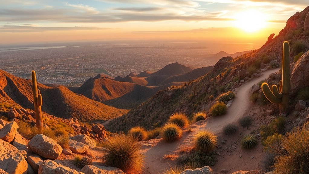
Piestewa Peak: Summit Trail and Foothill Access
If you want a hard urban-wilderness climb, Piestewa Peak delivers one near Phoenix. The Summit Trail climbs quickly with relentless switchbacks, rock steps, and open views.
Expect granite outcrops, creosote, palo verde, and broad valley panoramas. The route stays popular and exposed, so bring sun protection, water, and shoes with good traction.
For a gentler choice, use the Foothill Trail to link quieter segments, birdwatching areas, and shaded washes. Trailheads include parking and information kiosks, but weekends fill early.
Choose weekdays or early starts when you want fewer people. Piestewa gives you a compact, fitness-focused outing with fast access back to Tempe.
White Tank Mountain Regional Park: Waterfall Trail and Mesquite Loop
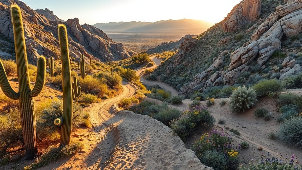
White Tank Mountain Regional Park gives you dramatic desert geology, seasonal water, and quiet wash scenery. Pair the Waterfall Trail with the Mesquite Loop when you want variety in one park visit.
The Waterfall Trail leads toward canyon walls, native plants, and a seasonal cascade after rain. The Mesquite Loop offers a calmer walk through desert trees, bird habitat, and shaded pockets.
Waterfall Trail Overview
The Waterfall Trail offers an easy-to-follow route with dramatic rock formations, blooming wildflowers in season, and a seasonal waterfall. You’ll also find ancient petroglyphs near the canyon area.
Visit after rain if you hope to see flowing water. At drier times, enjoy sculpted rock, quiet pools, and desert views.
- Watch for seasonal water that fills the canyon after storms.
- Look for petroglyph panels near the trail corridor.
- Use this route for a family-friendly hike with varied terrain.
Mesquite Loop Highlights
Take the Mesquite Loop for a quieter side of White Tank Mountain Regional Park. The route dips through groves of desert mesquite and palo verde, which offer limited shade and good bird habitat.
The gentle grade suits many fitness levels, and marked junctions help you stay on route. Watch for seasonal wildflowers, lizards on rocks, and tracks in sandy washes.
Pack water and sun protection even when you see shade. The Mesquite Loop gives you a calmer, nature-rich counterpoint to the park’s more rugged trails.
Rio Salado Pathways and Tempe Town Lake Riverside Walk
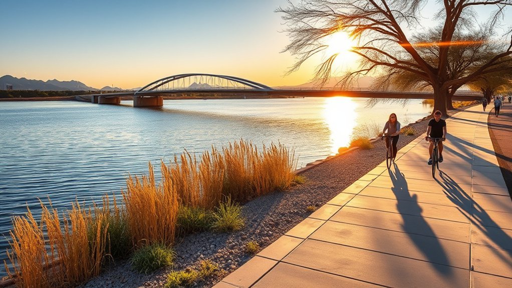
Choose the flat, accessible pathways along the Rio Salado and around Tempe Town Lake when you want an easy outing. These routes work well for walking, biking, rolling, or taking a relaxed family stroll.
Watch for birds, turtles, and other wildlife along the riparian edges. You’ll also get open water views, skyline scenes, and a low-effort break from steeper desert trails.
Flat, Accessible Pathways
The Rio Salado Pathways and Tempe Town Lake Riverside Walk make outdoor time simple. Both offer flat, well-paved surfaces for walkers, wheelchair users, and families with strollers.
You’ll find smooth asphalt and concrete paths, clear signage, shady rest spots, and several access points. Use these routes for quick morning walks, relaxed evening strolls, or steady exercise without tricky terrain.
- Use wide lanes to pass other people with more comfort.
- Take breaks at benches, water fountains, and shaded rest spots.
- Reach the paths from nearby parking, bike racks, and transit stops.
Wildlife and Scenic Views
You can often spot local wildlife from the paved trails. Great blue herons, egrets, turtles, and other animals use the riparian edges of Rio Salado and the calmer waters of Tempe Town Lake.
You’ll enjoy a mix of desert and riparian scenery. Cottonwoods, mesquite, and native grasses frame reflective water that draws birds and reptiles.
Bring binoculars for better views of wading birds and shorebirds. The Riverside Walk offers benches and viewpoints, while the Rio Salado Pathways reveal quieter stretches for nature watching.
How to Choose the Right Tempe-Area Hike
Match your hike to your time, group, and comfort with heat. Pick an easy route when you hike with kids, visitors, or anyone new to desert terrain.
Choose Papago Park for short scenic loops, Rio Salado for paved access, and South Mountain for a flexible half-day outing. Choose Camelback or Piestewa only when everyone in your group can handle steep, exposed climbing.
Pro tip: Save harder hikes for cooler mornings, and keep an easier backup route ready.
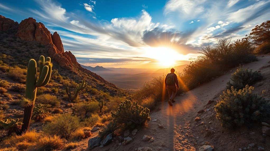
Desert Hiking Safety Near Tempe
Desert trails near Tempe can heat up fast, even when the route looks short. Carry water, use sun protection, and turn around before you feel overheated.
Wear shoes with grip because many trails include loose rock, granite steps, or slick sandstone. Tell someone where you plan to hike, especially when you choose a longer or less crowded route.
Dogs need extra care on hot trails. Check leash rules, bring water for your dog, and avoid pavement or rock that feels too hot for bare skin.
Frequently Asked Questions
Are Dogs Allowed on These Trails and Are Leashes Required?
Many Tempe-area trails allow dogs, but leash rules vary by park and trail. Bring waste bags, carry water for your dog, and check signs before you start.
What Are the Best Months for Avoiding Extreme Heat?
Late fall, winter, and spring usually give you the most comfortable hiking weather near Tempe. Summer heat can become dangerous, so choose sunrise walks, shaded routes, or indoor plans during very hot periods.
Is Mountain Biking Permitted on Any of These Hikes?
Some parks allow mountain biking on designated multiuse routes, but several steep summit trails restrict bikes. Check park signs and official trail maps before riding.
Where Can I Refill Water or Find Restrooms Nearby?
Trailheads, visitor centers, picnic areas, and nearby businesses often offer restrooms or water access. Don’t rely on every trailhead having working fountains, so fill bottles before you leave.
Are Any Trails Wheelchair or Stroller Accessible?
Yes, paved sections near Tempe Town Lake and Rio Salado work best for wheelchairs and strollers. Some Papago Park routes may suit sturdy strollers, but check surface, slope, and restroom access before you go.
Conclusion
The best hike near Tempe depends on how much effort, shade, and scenery you want. Start with Papago Park or Tempe Town Lake when you want an easy outing, and save Camelback or Piestewa for a prepared summit day.
Pack water, check trail rules, and choose your start time around the heat. With the right route, you can enjoy Arizona’s desert views without turning a fun hike into a risky one.
References
- Papago Park — City of Phoenix
- South Mountain Park and Preserve — City of Phoenix
- Camelback Mountain — City of Phoenix
- Usery Mountain Regional Park — Maricopa County Parks and Recreation
- Piestewa Peak and Dreamy Draw Recreation Area — City of Phoenix
- White Tank Mountain Regional Park — Maricopa County Parks and Recreation
- Tempe Town Lake — City of Tempe