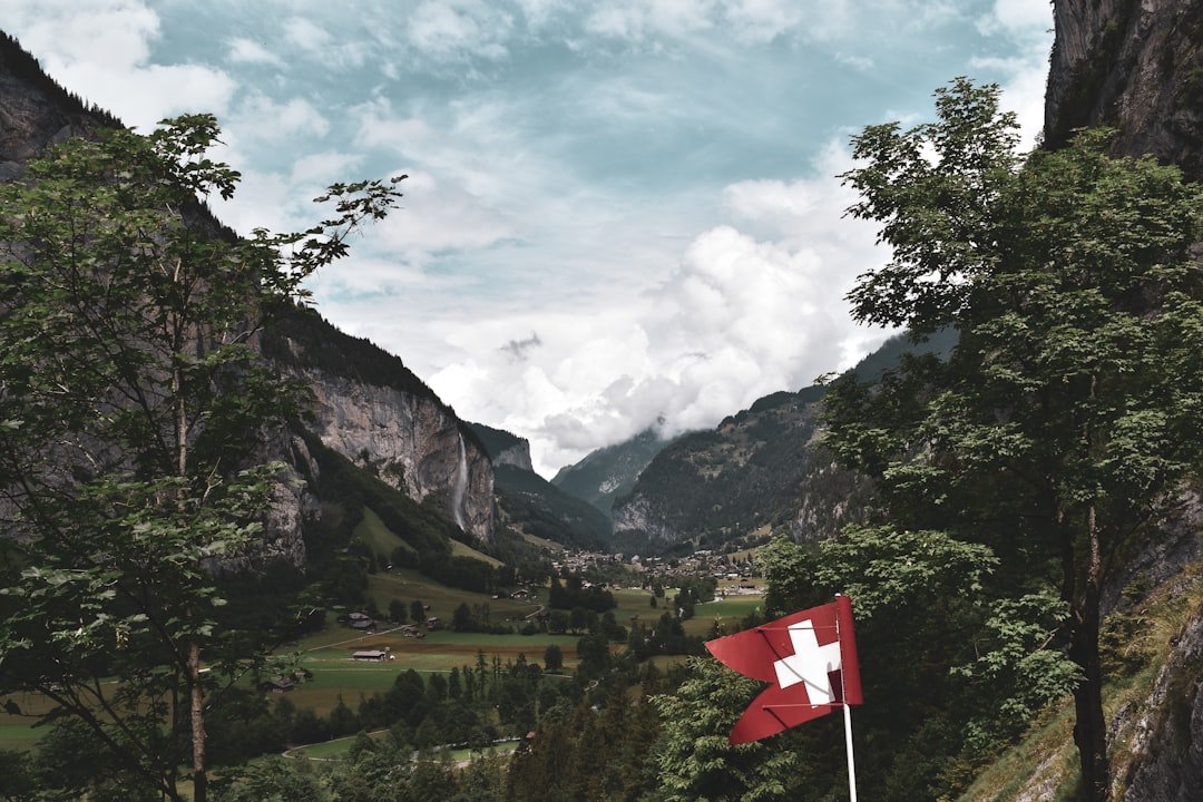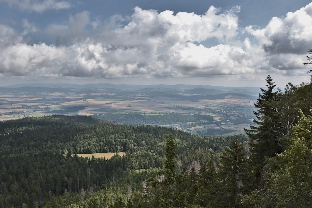
Nestled above Wilderswil in Switzerland’s Bernese Oberland, the Schynige Platte Panorama Trail combines a historic cogwheel-railway journey with one of the area’s most rewarding short mountain hikes. The circular route gives you broad views toward the Eiger, Mönch and Jungfrau, Lake Brienz, alpine meadows and rocky ridges without committing to an all-day trek.
Quick Answer
The Schynige Platte Panorama Trail is a roughly 6.1 km circular mountain hike that takes about 2.5 hours, or closer to 3 hours with photo stops. Expect about 300 m of climbing, wide views of the Bernese Alps and lakes, and a scenic cogwheel-train ride of roughly one hour from Wilderswil.
Key Takeaways
- The main Panorama Trail loop is about 6.1 km with roughly 303 m of ascent and descent.
- Allow about 2.5 hours for walking and longer if you stop frequently for photographs, food or the Alpine Garden.
- The historic Schynige Platte Railway takes roughly 53 to 60 minutes from Wilderswil to the mountain station.
- The trail is a moderate mountain walk, so sturdy footwear, suitable weather and reasonable fitness matter.
- For the 2026 season, Schynige Platte is scheduled to operate from June 13 through October 25, but you should always recheck operating and weather conditions before traveling.
At a Glance
| Time Required | About 2.5 hours hiking; allow 3 hours with stops. A full visit takes longer once the railway journey and other attractions are included. |
| Difficulty | Moderate mountain hike; about 6.1 km with roughly 303 m ascent and descent. |
| Tools Needed | Hiking shoes with good grip, layered clothing, rain and sun protection, water, snacks, phone and route information. |
| Cost | No separate fee is normally required simply to walk the trail, but railway transportation and optional food or other services cost extra. Check current Jungfrau fares before travel. |
Getting to the Schynige Platte
Most visitors reach Schynige Platte through Wilderswil, just outside Interlaken. Trains connect Interlaken Ost with Wilderswil, where you transfer to the historic Schynige Platte cogwheel railway.
The mountain railway is a major part of the experience rather than a quick transfer. According to Jungfrau Railways, the 7.3 km railway climbs about 1,420 vertical metres between Wilderswil and Schynige Platte. Regular operation of the railway dates back to 1893.
The journey from Wilderswil to Schynige Platte takes roughly 53 minutes to one hour, depending on the published service. As the train climbs, the scenery opens toward forests, alpine pastures and the surrounding lakes and mountains.
Note: For the 2026 season, Jungfrau lists Schynige Platte as available from June 13 through October 25. Mountain transportation is seasonal, so check the official Jungfrau operating information and timetable before you leave.
The mountain station sits at approximately 1,967 metres above sea level. The Panorama Trail can be reached directly from the station and mountain-hotel area, so there is no need for another lift or transfer after you arrive.
Pro Tip: Check the final return train before starting your hike. Leave enough extra time for viewpoints, the Alpine Garden and unexpected slower sections rather than planning to reach the station only minutes before the last departure.
Hiking the Schynige Platte Panorama Trail
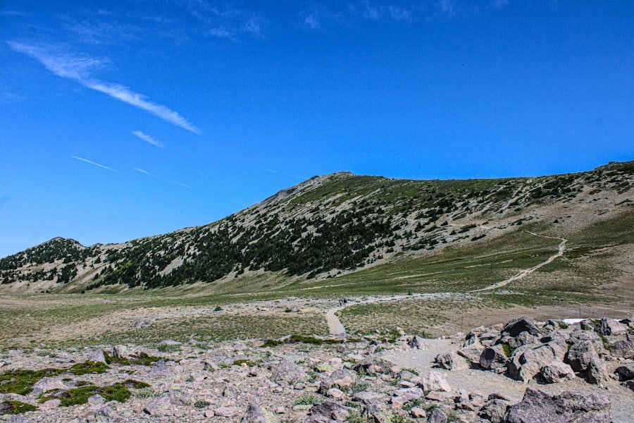
The commonly described Schynige Platte Panorama Trail is a circular hike beginning and ending near the mountain station. Detailed route information published by Berner Wanderwege through Outdooractive gives a distance of about 6.1 km, approximately 303 m of ascent and 303 m of descent, and a walking time of about 2 hours 15 minutes. Jungfrau recommends allowing about 2 hours 30 minutes for its Panorama Hike.
For most visitors, budgeting 2.5 to 3 hours is more realistic because the views encourage frequent stops. Weather, trail traffic and your fitness can also change your actual walking time.
Products Worth Considering

-Scratch-Resistant & Wear-Resistant- --Made of polyester fabric, it can effectively resist wear, tear and scratches in outdoor use. The surface of the backpack is treated with a water-repellent coating, which is very suitable for hiking, cycling, etc

Lightweight: The lightweight packable backpack is about half the weight of a mobile phone, being folded into its inner pocket for storage and easy to open when needed. Unfolded size: 12.5 x 8.5 x 20.9 inches, folded size is only 4.5 x 3.9 x 7.8 inches

Compact & Packable: This 20L hiking backpack measures 11.4 × 5.1 × 18.5 inches, weighs only 0.64 lbs, and folds down to just 6.3 × 7.1 inches. It easily packs into its own inner pocket and fits neatly in your suitcase, larger backpack, or car
A Simple Route Overview
- Begin near the Schynige Platte mountain station and mountain-hotel area.
- Follow the marked panorama-hike route toward the Tuba/Daube viewpoint area.
- Continue along the panoramic mountain path around the Oberberghorn area and in the direction of Loucherhorn.
- At the Grätli junction, follow the route toward Oberberg.
- Pass the Oberberg huts and continue back toward Schynige Platte and the railway station.
The route crosses alpine meadows and uneven mountain terrain rather than a level paved path. Sections are easy to walk in good conditions, while other portions require more attention to footing.
The appeal of the Panorama Trail is its variety: within a relatively short loop you can see the Bernese Alps, Lake Brienz, high alpine meadows and rocky ridges.
Do not confuse this loop with the much longer Schynige Platte to Faulhorn and Grindelwald-First hike. Jungfrau describes that high-altitude route as an approximately six-hour outing. It requires significantly more time, stamina and transportation planning.
Flora and Fauna Along the Trail
| What You May See | Likelihood | What to Know |
|---|---|---|
| Alpine wildflowers | Common in flowering season | The mix changes through the summer. Stay on marked paths and do not pick protected or garden plants. |
| Marmots | Possible | The detailed Panorama Trail route notes marmot colonies in the area. Sightings are never guaranteed. |
| Grazing livestock | Possible in pasture season | Give cattle plenty of room, avoid touching calves and keep dogs under close control. |
| Alpine birds | Variable | Bird activity changes with weather, season and time of day, so avoid relying on promised species sightings. |
Schynige Platte is especially notable for alpine plants. The Botanical Alpine Garden Schynige Platte states that it displays around 800 species native to the Swiss Alps in natural plant communities.
Flowering conditions are not identical every year. Temperature, snowmelt and weather affect what is blooming at a given time. Gentians and many other alpine species appear during different parts of the season, so a June visit can look very different from an August or September visit.
Marmots are among the more interesting animals you may encounter around the route. Watch quietly from a distance rather than approaching or feeding wildlife.
Note: Wildlife sightings are unpredictable. Treat any animal encounter as a bonus rather than planning the hike around guaranteed sightings.
Points of Interest and Photo Opportunities
Several worthwhile stops can be combined with the Panorama Trail, beginning with the Botanical Alpine Garden near the mountain station.
The Botanical Alpine Garden displays around 800 species native to the Swiss Alps at roughly 1,967 metres above sea level.
The garden is both a visitor attraction and a centre for research and nature conservation. Its paths let you examine alpine plants much more closely than you normally can while concentrating on your footing during a mountain hike.
For 2026, the garden lists opening dates of June 13 through October 25 and hours of 08:00 to 18:00. Because flowering depends strongly on weather, the exact display changes throughout the season.
Tuba and Daube Viewpoint Area
The elevated viewpoint section near Tuba/Daube is one of the most memorable parts of the loop. From the ridge you can look across the Bernese Oberland toward the high mountains while seeing deep into the valleys and toward Lake Brienz.
Eiger, Mönch and Jungfrau Views
The Eiger, Mönch and Jungfrau form the dominant mountain backdrop from many parts of Schynige Platte. Instead of limiting yourself to one designated photo stop, watch how the composition changes as you move around the loop.
Schynige Platte Railway
The historic train is also worth photographing. Jungfrau Railways states that the Schynige Platte Railway began regular service in 1893, giving the journey an atmosphere quite different from a modern gondola ride.
Schynige Platte Skywalk
Near the mountain hotel, the Schynige Platte Skywalk provides another easy viewpoint before or after the hike. It is especially useful if some members of your group want mountain views without completing the full Panorama Trail.
Pro Tip: If photography is a priority, build at least 30 to 45 minutes of extra time into the published hiking duration. The most scenic ridge sections are exactly where you are likely to stop most often.
Safety Tips for Hiking the Trail
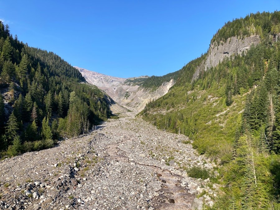
Although the Panorama Trail is short compared with major alpine treks, it is still a mountain hike. Uneven ground, wet rocks, strong sun, wind, cloud and rapidly changing weather can turn an easy-looking outing into a more demanding one.
Warning: Do not start or continue onto exposed mountain terrain when thunderstorms or severe weather threaten. Check the MeteoSwiss hazard information, local forecast and current trail conditions before setting out.
Products Worth Considering

Mens hiking boots made of premium synthetic suede. SL-TEX waterproof membrane prevents water from entering and volatilizes water vapor. Ultra-light weight: 1.25lb (size 10)
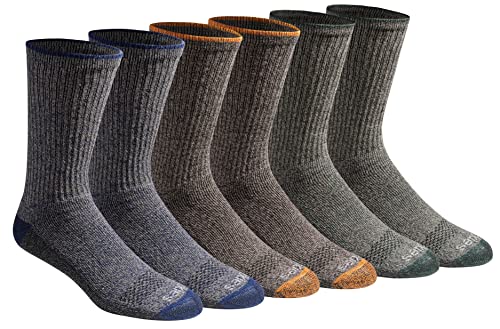
Soft Breathable Moisture Control Fibers

TREKKING PARTNER - It's a wonderful experience to gather with friends for outdoor camping, barbecues, or mountain climbing on weekends and enjoy the beauty of nature. These ANJOUFEMME hiking boots for women will accompany you through every memorable moment
Wear Proper Footwear
Choose hiking shoes or boots with good grip. Smooth-soled city shoes are a poor choice once the trail becomes wet or uneven.
Dress in Layers
Temperatures near 2,000 metres can feel very different from Interlaken or Wilderswil. Carry a warm layer plus rain and wind protection even when conditions in the valley look comfortable.
Carry Water and Food
Bring enough water for the hike rather than depending on finding drinking water along the trail. Snacks such as fruit, sandwiches, nuts or energy bars are useful if the walk takes longer than expected.
Protect Yourself From the Sun
Sun exposure can be strong at altitude. Sunscreen, sunglasses and a hat are useful even when temperatures feel cool.
Stay on Marked Paths
Swiss Hiking Trails recommends following marked routes, checking weather and route details before departure, carrying navigation information and using appropriate hiking equipment. Staying on the trail also reduces damage to fragile alpine vegetation.
Know When to Turn Around
If weather worsens, footing becomes uncomfortable or someone in your group is struggling, turn back rather than forcing the original plan. Published hiking times are guidelines, not deadlines.
Dining and Accommodation Options
After the hike, you can eat at Schynige Platte instead of immediately boarding the train downhill. The Panorama Restaurant and mountain hotel near the station serve as the main dining and accommodation option at the summit area, with views toward the Eiger, Mönch and Jungfrau.
A bistro is also located near the summit station for travelers looking for drinks or a quicker snack while waiting for the train.
If you prefer a wider range of restaurants and hotels, Wilderswil and Interlaken make convenient bases. Staying in the valley also gives you easier access to other parts of the Jungfrau Region.
Travelers planning a very early start, a sunset-oriented stay or additional hiking may prefer spending a night at the mountain hotel, while day visitors can comfortably return to Wilderswil or Interlaken after the hike as long as they plan around the railway timetable.
Additional Activities and Attractions in the Area
The Panorama Trail is only one of several things to do at Schynige Platte. Visitors with extra time can combine the hike with the Botanical Alpine Garden, Skywalk or the shorter Swiss Flower & Panorama Trail.
Jungfrau also advertises traditional alphorn performances near the railway station during the operating season. Because programming can change, confirm current times on the official Schynige Platte page before planning your day around a performance.
More experienced hikers can consider the much longer high-altitude route from Schynige Platte toward Faulhorn, Bachalpsee and Grindelwald-First. Jungfrau lists the Schynige Platte to First outing at around six hours, so it should be treated as a separate mountain-hiking day rather than an extension you casually add to the Panorama Trail.
Elsewhere in the region, Grindelwald and Lauterbrunnen offer additional mountain scenery, shops, restaurants and hiking connections. Interlaken is also a major base for activities such as paragliding, while Lake Thun and Lake Brienz provide boat-trip options for a less strenuous day.
Overall, Schynige Platte works especially well when you want a manageable alpine hike without giving up the classic Bernese Oberland scenery. The train journey, panoramic loop, Alpine Garden and mountain viewpoints can comfortably fill most of a day when you avoid rushing between them.
Before leaving for Wilderswil, check the current timetable, weather, trail information and final return connection. This is much more useful than relying on fixed times or seasonal details from an older trip report because mountain operations can change with weather and operating conditions.
Frequently Asked Questions
What is the Schynige Platte Panorama Trail?
The Schynige Platte Panorama Trail is a circular mountain hike above Wilderswil in the Bernese Oberland. It offers views of the Eiger, Mönch and Jungfrau, Lake Brienz, alpine meadows and the surrounding ridges before returning to the Schynige Platte station area.
How long is the Schynige Platte Panorama Trail?
Detailed route information gives a distance of about 6.1 km, with roughly 303 m of ascent and descent. The published walking time is approximately 2 hours 15 minutes to 2 hours 30 minutes, but allowing up to 3 hours is sensible if you stop frequently.
How difficult is the Schynige Platte Panorama Trail?
It is best treated as a moderate mountain hike rather than a flat sightseeing walk. You should be comfortable walking for several hours on uneven paths and climbing roughly 300 vertical metres. Good footwear and suitable weather are important.
How do I reach the Schynige Platte Panorama Trail?
Travel to Wilderswil and take the historic Schynige Platte cogwheel railway to the mountain station. The railway ride takes roughly 53 minutes to one hour. The trail starts close to the station and mountain-hotel area.
What are the main highlights of the trail?
Highlights include views toward the Eiger, Mönch and Jungfrau, Lake Brienz, alpine meadows, the Tuba/Daube viewpoint area, the historic cogwheel railway and the nearby Botanical Alpine Garden.
Are there facilities at Schynige Platte?
Yes. Facilities around the mountain-station area include dining, the mountain hotel, the Botanical Alpine Garden and other visitor attractions. Facilities are more limited once you are out on the hiking loop, so carry your own water and snacks.
When is the best time to hike the Schynige Platte Panorama Trail?
The practical hiking season follows the seasonal mountain-railway operation. For 2026, Schynige Platte is scheduled from June 13 through October 25. Summer generally offers the broadest choice of hiking days and flowers, but weather and trail conditions should always determine whether you hike.
Is the Schynige Platte Panorama Trail suitable for children?
Older children who already enjoy mountain walking may manage the route well, but suitability depends on their experience, stamina, weather and trail conditions. The full loop should not be treated as an effortless stroller-friendly family walk.
Can I see marmots on the Panorama Trail?
Possibly. The detailed route information mentions marmot colonies in the area, but sightings depend on season, weather, time of day and animal activity. Keep your distance and never feed wildlife.
Sources
- Jungfrau Railways: Panorama Hike Schynige Platte — official hiking duration, route description and mountain-hiking guidance.
- Jungfrau Railways: Schynige Platte — railway access, attractions, seasonal visitor information and mountain facilities.
- Berner Wanderwege route data via Outdooractive — detailed distance, duration, ascent, descent and route sequence.
- Botanical Alpine Garden Schynige Platte — elevation, alpine-flora information and current species count.
- Swiss Hiking Trails — hiking preparation, equipment, trail etiquette and safety guidance.
- MeteoSwiss — official Swiss weather-hazard information.