The 5 Lakes Walk in Zermatt, also known as the 5-Seenweg, links five high-altitude lakes above the village with wide views of the Matterhorn and surrounding Alps. The standard route runs from Blauherd to Sunnegga through Stellisee, Grindjisee, Grünsee, Moosjisee, and Leisee. It is a moderate mountain hike rather than a simple paved walk, so good footwear, suitable weather, and enough time are important.
Quick Answer
The 5 Lakes Walk Zermatt is a moderate mountain route from Blauherd to Sunnegga that passes Stellisee, Grindjisee, Grünsee, Moosjisee, and Leisee. Official sources publish slightly different measurements, so plan roughly 3–4 hours for the hike plus photo and rest stops, and check current lift and trail conditions before starting.
Key Takeaways
- The standard route runs from Blauherd to Sunnegga and follows the lakes in this order: Stellisee, Grindjisee, Grünsee, Moosjisee, and Leisee.
- Zermatt Tourism classifies the route as Moderate T2, so it requires more care than an ordinary town or lakeside walk.
- Official sources currently publish distances of about 9.8–11.3 km and walking times of roughly 2.5–3.5 hours, depending on the route measurement used.
- June through September is the main hiking period, but snow, storms, and mountain-lift schedules can affect access.
- Swimming is normally permitted at Grünsee and Leisee when local signs do not prohibit it.
- Good hiking shoes, water, food, sun protection, rain protection, and layers are sensible even on a clear morning.
At a Glance
| Time Required | Allow about 3–4 hours for most visitors, plus extra time for long breaks, swimming, or photography. |
| Difficulty | Moderate T2 according to Zermatt Tourism. Expect uneven mountain paths plus both uphill and downhill sections. |
| Official Distance | About 9.8–11.3 km depending on the official mapping and route measurement used. |
| Start / Finish | Blauherd to Sunnegga in the standard direction. |
| Gear Needed | Grippy hiking shoes, water, snacks, sun protection, warm layer, rain protection, and optional hiking poles. |
| Cost | There is no separate trail fee, but mountain transport is paid. For 2026, the adult Five Lakes combination ticket is listed at CHF 48 during the applicable shoulder-season period and CHF 53 in July–August, before eligible reductions. Always check current pricing before travel. |
Best Time to Hike the 5 Lakes Walk
The main hiking season is summer. Zermatt Bergbahnen lists June through September as the best period for the Five Lakes Trail. The exact opening date can vary because high-altitude trails depend on snow conditions and mountain-transport operations.
For the 2026 season, the dedicated Five Lakes Walk combination ticket is advertised from June 13 through October 4. That does not guarantee identical trail conditions every day, so check the latest information shortly before leaving.
July and August usually bring the busiest hiking period. June can provide greener slopes and remaining snow on higher peaks, while September often offers cooler walking conditions and fewer peak-season visitors. Early October can sometimes work when lifts and trails remain open, but it should not be assumed to have summer conditions.
Warning: Do not rely on the calendar alone. Snow, thunderstorms, strong wind, maintenance, or lift closures can affect the route even during the normal hiking season. Check the official trail and mountain-railway status on the day of your hike.
The normal Five Lakes Walk should not be treated as a standard winter hiking route. Zermatt maintains separate winter trails, and snow-covered mountain paths require different equipment and experience.
How to Reach the Trail
The easiest standard approach begins in Zermatt. Walk to the Sunnegga-Rothorn valley station, take the underground funicular to Sunnegga, and continue by mountain lift to Blauherd. Blauherd sits at 2,571 metres and is the usual starting point for the Five Lakes Walk.
The official combination ticket for the hike includes the journey from Zermatt to Blauherd and the return journey from Sunnegga to Zermatt. Current prices, reductions, and operating dates are available from Zermatt Bergbahnen’s Five Lakes combination-ticket page.
Zermatt itself is car-free for ordinary private vehicles. Visitors arriving by car normally park outside the village, commonly in Täsch, and continue by train or authorized transport into Zermatt.
Note: Zermatt Tourism warns that a hiking route can appear open even when the mountain railway needed to reach its starting point is not operating. Check both the trail status and lift timetable.
What to Expect on the 5 Lakes Walk
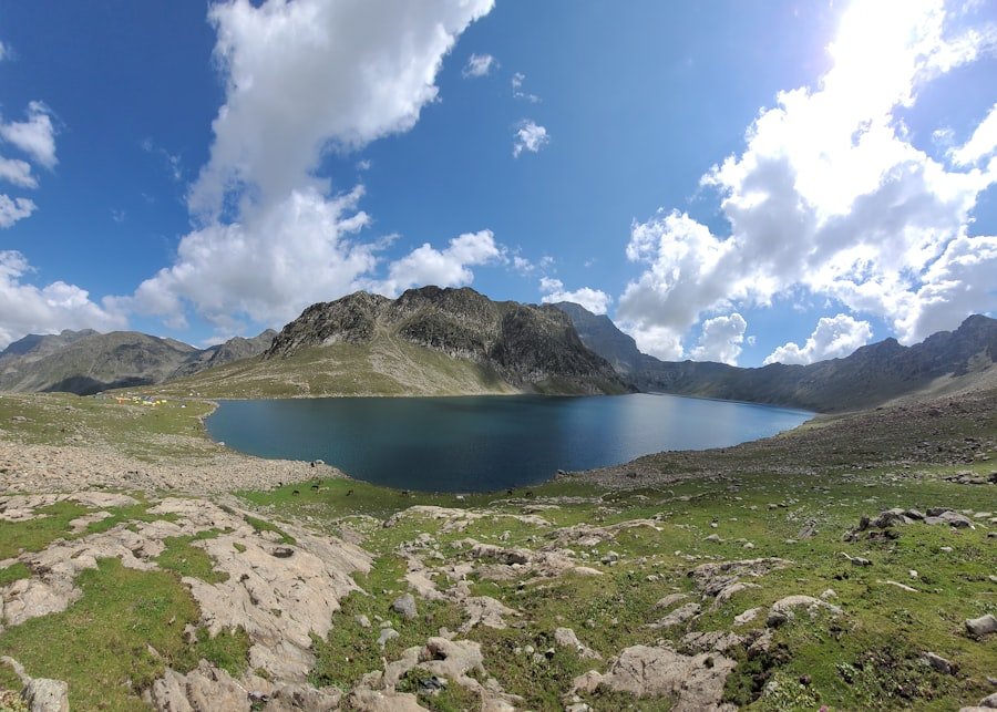
The standard route runs:
Blauherd → Stellisee → Grindjisee → Grünsee → Moosjisee → Leisee → Sunnegga.
Zermatt Tourism’s official Route No. 11 lists the hike at 11.3 km, about 3 hours 30 minutes, with roughly 265 m of ascent and 542 m of descent. Zermatt Bergbahnen’s Five Lakes Trail page lists 9.8 km and about 2 hours 30 minutes. Differences in mapped start points and route measurement can produce different totals, so it is more useful to budget enough time than to plan around a single exact kilometre figure.
For relaxed sightseeing, photos, food stops, and short breaks, budgeting about 3–4 hours on the trail is more practical than treating the published minimum walking time as a deadline.
| Route Order | What to Know | Matterhorn Reflection | Swimming |
|---|---|---|---|
| Blauherd → Stellisee | High starting point and one of the classic Matterhorn views. | Yes, in suitable calm conditions | No designated recommendation |
| Stellisee → Grindjisee | Alpine vegetation and another well-known reflection location. | Yes, in suitable conditions | No designated recommendation |
| Grindjisee → Grünsee | More rugged terrain and a good place for a rest or picnic. | Views vary by position | Allowed when signs do not prohibit it |
| Grünsee → Moosjisee | Moosjisee is a reservoir known for its distinctive glacier-fed colour. | Not the main reflection stop | No |
| Moosjisee → Leisee → Sunnegga | Family-friendly facilities around Leisee before the final section to Sunnegga. | Leisee can reflect the Matterhorn | Leisee: allowed when signs do not prohibit it |
The Five Lakes Explained
Stellisee
Stellisee is one of the best-known photography stops on the route. When the air is still and the surface is calm, the Matterhorn can appear reflected in the lake. Wind, cloud, and changing light mean the reflection is never guaranteed, which is one reason early, calm periods are especially attractive to photographers.
Grindjisee
Grindjisee combines water, larches, alpine plants, and mountain views. Zermatt Tourism highlights the area for its alpine flowers, and the Matterhorn can also be reflected in the lake under suitable conditions.
Grünsee
Grünsee has a more rugged setting and is one of the two lakes where swimming is normally permitted when no local signs say otherwise. The water remains cold even in summer, so entering it should be a personal comfort and safety decision rather than an assumed part of the hike.
Moosjisee
Moosjisee looks different from the other lakes because it is a storage reservoir. Its glacier-fed water gives it a distinctive pale or turquoise appearance. Treat reservoir infrastructure and warning signs seriously and remain on the marked walking route.
Leisee
Leisee is close to Sunnegga and has a more family-oriented atmosphere, with picnic and play facilities in the surrounding area. It is also one of the approved swimming locations when conditions and signs allow. In suitable light, the lake can provide another Matterhorn reflection.
Official descriptions and current information about these lakes are available from Zermatt Tourism’s mountain-lakes guide.
Tips for Hiking the 5 Lakes Walk
Preparation makes the route more comfortable and safer. Wear shoes with good grip rather than relying on smooth everyday sneakers. The path includes uneven mountain terrain, and wet sections can become slippery.
Carry enough water and some food even if you plan to stop at a mountain restaurant. Opening hours can vary, and having your own supplies means you are not dependent on a particular business being open.
Dress in layers. Conditions above 2,000 metres can feel very different from conditions in Zermatt village, and cloud, wind, or rain can change the temperature quickly. A light waterproof layer is useful even when the morning looks clear.
Pro Tip: If Matterhorn reflections are a priority, give yourself time at Stellisee, Grindjisee, and Leisee. Calm water matters as much as sunlight, so rushing from lake to lake can work against good photography.
Hiking poles are optional but can help people who prefer extra stability on descents. Sun protection is also important because much of the route is exposed.
The official route is listed as suitable for children from around age six, but that does not mean every child of that age will enjoy the full hike. Consider the child’s hiking experience, stamina, weather, and how often your group expects to stop.
Wildlife and Alpine Flora
The trail passes through varied alpine environments, from open slopes to areas with larches and mountain vegetation. Grindjisee is particularly noted for alpine flowers, while other parts of the route become more barren and rocky.
Wildlife sightings vary from day to day. Alpine birds and marmots may sometimes be seen in the wider area, while animals such as ibex and golden eagles also occur in the Zermatt region. None should be treated as a guaranteed sighting on the Five Lakes Walk.
The smaller details are part of the walk too: alpine flowers, larches, changing rock, water colour, and the transition from high mountain terrain toward Sunnegga.
Stay on marked paths, avoid picking protected plants, keep a respectful distance from animals, and never feed wildlife.
Safety Precautions
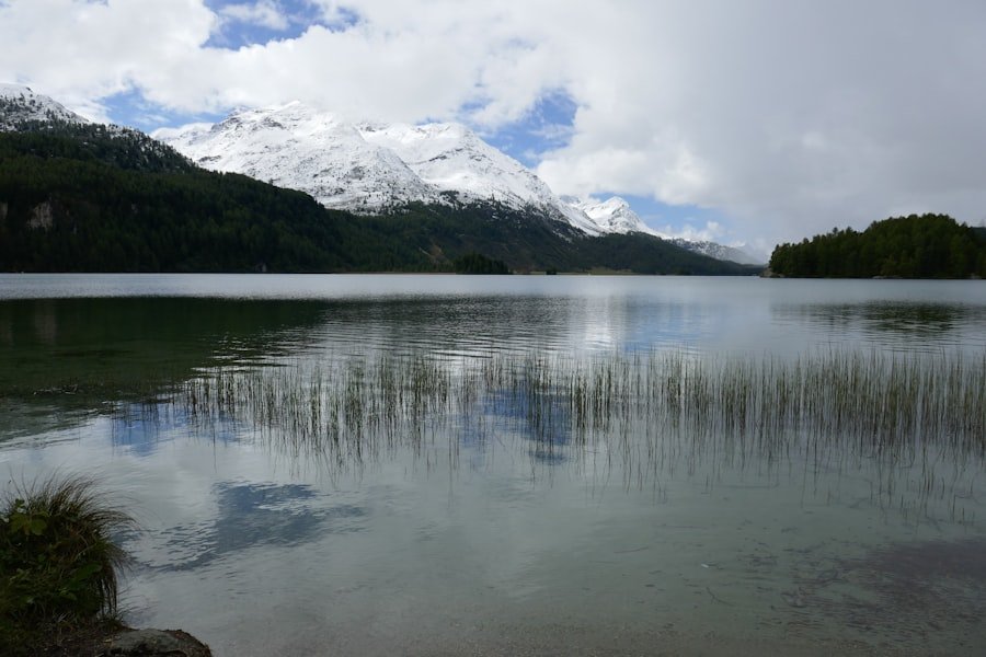
Mountain weather can change quickly. Check the forecast, current trail information, and lift status before leaving Zermatt. If cloud, thunderstorms, strong winds, or other conditions make the route unsafe, change your plans rather than trying to complete the hike at all costs.
Zermatt Tourism recommends suitable footwear, weather-appropriate clothing, rain protection, enough provisions and water, and turning back early when conditions become uncertain. Hikers should remain on marked paths and pay attention to warning signs, particularly around waterways, reservoirs, and water intakes.
Warning: The Five Lakes Walk is classified as Moderate T2. Do not assume that its popularity makes it risk-free. Wet ground, sudden weather changes, altitude, fatigue, and missed lift connections can all turn an otherwise straightforward outing into a problem.
Tell someone your plan if you are hiking alone, keep your phone charged, and know your return options. If you are uncomfortable navigating mountain trails independently, a guided hike can provide additional support.
Can You Hike the Route in Reverse?
Yes, but the standard direction from Blauherd to Sunnegga is usually more convenient because it starts higher and finishes lower. Zermatt Tourism estimates roughly 3 hours 50 minutes when the route is walked in the opposite direction.
Starting from Sunnegga also changes the amount and timing of uphill walking, so visitors choosing the reverse route should plan their energy and lift connections accordingly.
Nearby Attractions and Amenities
Zermatt offers shops, cafés, restaurants, accommodation, and mountain transport before and after the hike. Because ordinary private cars do not enter the village, most visitors move around on foot or use approved electric transport.
For another high-mountain viewpoint, the Gornergrat provides views of 29 peaks above 4,000 metres according to Gornergrat Bahn. It is reached by cogwheel railway and works well as a separate excursion rather than something to squeeze into the same hiking schedule.
Another major excursion is Matterhorn Glacier Paradise. Its viewing platform is at 3,883 metres and provides a very different high-alpine experience from the Five Lakes Walk.
If you want to swim during the hike, plan around Grünsee or Leisee and obey any signs posted at the water. Leisee is especially convenient for families because of the surrounding recreational facilities.
Why the 5 Lakes Walk Is Worth Doing
The strongest reason to choose the 5 Lakes Walk is the variety packed into a single mountain hike. You move between five lakes with different colours and surroundings while the Matterhorn repeatedly appears from changing angles.
The route also gives visitors flexibility. Photographers can spend longer around the reflection lakes, families can take more time near Leisee, and hikers who simply want the complete circuit can maintain a steady pace between Blauherd and Sunnegga.
It is still important to approach the trail as a real mountain hike. Good shoes, sensible weather decisions, enough water, and attention to lift schedules matter more than how frequently the route appears in travel photos. With those basics covered, the Five Lakes Walk offers one of the most varied half-day hiking experiences above Zermatt.
If you also enjoy separate food-focused reading, the site has an article on exploring the delightful world of Asian melon. It is unrelated to the hiking route but may be of interest as additional reading.
Frequently Asked Questions
What is the 5 Lakes Walk Zermatt?
The 5 Lakes Walk, or 5-Seenweg, is a mountain hiking route above Zermatt that connects Stellisee, Grindjisee, Grünsee, Moosjisee, and Leisee. The standard direction runs from Blauherd to Sunnegga.
How long is the 5 Lakes Walk?
Current official sources publish slightly different measurements. Zermatt Tourism lists 11.3 km and about 3 hours 30 minutes, while Zermatt Bergbahnen lists 9.8 km and about 2 hours 30 minutes. Allowing roughly 3–4 hours gives most hikers more practical time for stops.
How difficult is the 5 Lakes Walk?
Zermatt Tourism classifies the route as Moderate T2. It includes uneven mountain paths, uphill sections, and a larger overall descent from Blauherd toward Sunnegga. Good footwear and normal hiking fitness are recommended.
What are the five lakes on the route?
The five lakes are Stellisee, Grindjisee, Grünsee, Moosjisee, and Leisee. Schwarzsee is not one of the lakes on the official Five Lakes Walk.
When is the best time to hike the 5 Lakes Walk?
June through September is the main recommended hiking period. Exact opening conditions depend on snow, weather, and mountain-lift operations, so always check the current status before travelling to the start.
Can you swim in the lakes?
Swimming is normally allowed at Grünsee and Leisee when there are no signs prohibiting it. The water can be very cold even in summer, and posted local restrictions always take priority.
Is the 5 Lakes Walk suitable for children?
The official Zermatt route information lists the hike as suitable for children from about age six. Parents should still consider the child’s experience, stamina, weather conditions, and ability to walk safely on uneven mountain paths.
Where are the best Matterhorn reflections?
Zermatt Tourism identifies Stellisee, Grindjisee, and Leisee as lakes where the Matterhorn can be reflected. Calm water and clear visibility are important, so reflections are never guaranteed.
Sources
- Zermatt Tourism: 5-Lake Route No. 11 — official route order, difficulty, distance, duration, elevation, family guidance, equipment, and safety information.
- Zermatt Bergbahnen: Five Lakes Trail — alternate official route measurement, season, swimming rules, and lake information.
- Zermatt Bergbahnen: Five Lakes Combination Ticket — transport coverage, operating period, and reductions.
- Zermatt Tourism: Mountain Lakes — Grindjisee, Grünsee, Leisee, and other lake characteristics.
- Gornergrat Bahn — Gornergrat panorama and 4,000-metre peak information.
- Matterhorn Paradise: Matterhorn Glacier Paradise — official elevation and viewing-platform information.