Creux du Van is a huge horseshoe-shaped rock cirque in Switzerland’s Jura Mountains, above the Val-de-Travers and Lake Neuchâtel. Its limestone wall rises to about 160 meters, and the landscape was shaped over time by erosion from water and ice. For hikers, the classic approach from Noiraigue combines a steep forest climb, open Jura scenery, wildlife habitat, and dramatic views from the rim.
Quick Answer
The classic Creux du Van hike from Noiraigue is a 15 km circular route with about 780 m of ascent and an estimated hiking time of 4 hours 35 minutes. The trail is technically straightforward but physically demanding. May through October is the normal hiking season, and extra care is essential near the exposed cliff rim.
Creux du Van is sometimes described as Switzerland’s Grand Canyon, but its setting is very different from a desert canyon. Forest, alpine vegetation, pastureland, limestone cliffs, and protected wildlife habitats meet in a relatively compact area. Ibex and chamois are among the animals associated with the reserve, although wildlife sightings are never guaranteed.
Key Takeaways
- The standard SwitzerlandMobility circuit starts and ends in Noiraigue and covers about 15 km with 780 m of ascent.
- Allow roughly 4 hours 35 minutes of walking time, plus extra time for rests, photos, wildlife viewing, and meals.
- The route is technically rated easy as a hiking trail, but the physical requirement is medium because of the long climb.
- May through October is the listed season for the standard route. Winter conditions can make paths slippery and some roads inaccessible.
- Wild camping and parking outside official areas are prohibited around the protected site.
- Stay well back from the cliff edge, carry enough water and food, and check current weather and access conditions before setting out.
At a Glance
| Time Required | About 4 hr 35 min of hiking for the standard Noiraigue circuit, plus breaks |
| Difficulty | Technically easy hiking trail; medium physical requirement; about 780 m ascent |
| Tools Needed | Hiking shoes with good grip, water, food, weather layers, rain protection, charged phone, and a hiking map |
| Cost | No general trail ticket is normally required; transport, parking, meals, guided tours, and accommodation cost extra |
Getting to Creux du Van
Noiraigue is the most useful starting point for the classic Creux du Van hike. The official SwitzerlandMobility Route 286 begins and ends there, making the village a convenient choice if you want to complete the full circular walk.
Travelers using public transport can reach Noiraigue railway station and start the hike from the village. Check the current timetable before traveling because connections and departure times can change. From the station area, follow the marked walking route toward the forest and the climb leading to Creux du Van.
If you drive, use only official parking areas. According to Neuchâtel Tourism’s current access guidance, several parking choices serve Creux du Van. During the May-to-October period, the Soliat car park can place visitors only a few minutes on foot from the rim, while other parking areas provide longer approaches.
From November through April, road access changes significantly. Some roads are not cleared of snow, and winter tires or snow chains may be required on certain approaches. The walking paths can also become very slippery.
Pro Tip: If your goal is the complete hiking experience, start from Noiraigue. If your main goal is simply to see the rock amphitheater, check the current Soliat or Grand’Vy parking access and choose a shorter walk instead of committing to the full 15 km circuit.
Hiking Routes and Trails
Creux du Van can be approached in several ways, so route descriptions online do not always show exactly the same distance or ascent. For a consistent reference, this guide uses the official Sentier du Creux du Van circular route from Noiraigue as the main hike.
Classic Noiraigue Circular Hike
The mapped circuit covers about 15 km, takes approximately 4 hours 35 minutes of walking time, and includes around 780 m of ascent and descent. SwitzerlandMobility describes the technical requirements as easy but the physical requirements as medium. That distinction matters: you do not need climbing skills, but you should be ready for a sustained uphill effort.
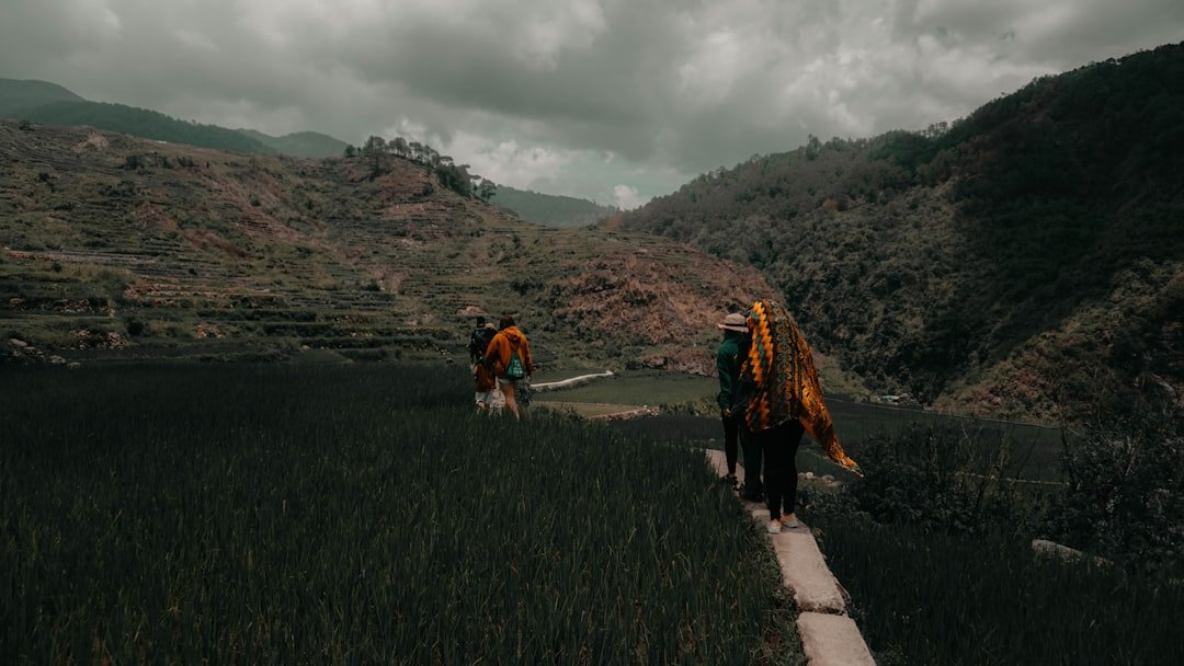
The route leaves Noiraigue, climbs through forest, reaches the upper Creux du Van landscape, follows the rim area, and eventually returns to the valley. Plan additional time if you want long photo stops, wildlife watching, or a meal.
Trail of the 14 Contours
The famous Path of the Fourteen Bends, or Sentier des 14 Contours, climbs from Noiraigue toward Le Soliat through a series of tight switchbacks. Neuchâtel Tourism lists roughly 745 m of ascent for this uphill route and describes it as sporty and challenging.
If you see a guide claiming that Creux du Van is an easy two-hour outing, check which route it describes. A short viewpoint visit, a one-way ascent, and the full Noiraigue loop are very different trips.
Short Viewpoint Visit
You do not have to hike the complete Noiraigue circuit to see the cliffs. From May through October, official access guidance lists the Soliat car park at roughly five minutes on foot from the Creux du Van edge and the Grand’Vy car park at roughly 15 minutes. These options are useful for visitors who want the viewpoint without a 15 km hike.
Note: Route statistics can vary slightly between guides because there are several ways to approach and circle Creux du Van. Always compare the stated trailhead, route direction, distance, and elevation gain before deciding how much time you need.
What to Pack
- Hiking shoes or boots with reliable grip
- Enough water for the entire outing
- Lunch or energy-rich snacks
- Light insulating layers
- Waterproof jacket
- Sun protection
- Charged phone and offline map or hiking map
- Small first-aid kit
- Trekking poles if they help you on steep or uneven ground
Flora and Fauna of Creux du Van
| Category | What You May Encounter |
|---|---|
| Flora | Forest vegetation, Jura pastureland, and alpine plants along the ridge, including anemones, asters, and gentians |
| Fauna | Ibex, chamois, marmots, deer, and birds of prey are associated with the wider Creux du Van landscape |
| Conservation | Creux du Van is part of a protected landscape and includes a cantonal nature reserve and federal wildlife-protection area |
The ecological value of Creux du Van comes from the close mix of cliffs, forests, meadows, pasture, and cooler sheltered areas. Vegetation changes as you climb from the wooded lower slopes toward the exposed upper landscape.
Wildlife is one of the major attractions, but animals should be viewed from a respectful distance. Do not approach, feed, chase, or surround them for photographs. Quiet observation gives animals more space and usually gives you a better experience as well.
The Canton of Neuchâtel identifies Creux du Van as a landscape of exceptional geological, ecological, and scenic value and lists the Creux-du-Van nature reserve among the canton’s protected territories. You can read the official protection overview on the Canton of Neuchâtel website.
The landscape is not only a viewpoint. It is also protected habitat, so staying on appropriate paths and giving wildlife space is part of visiting responsibly.
Safety Tips for Hiking in Creux du Van
The main danger is not technical climbing. It is the combination of a long ascent, uneven ground, exposed viewpoints, fast-changing weather, and the high cliff edge. Choose a route that matches your fitness and turn back if conditions deteriorate.
Warning: Keep a generous distance from the cliff edge. Wet rock, mud, ice, snow, fog, strong wind, distraction, and crowded viewpoints can increase fall risk. Do not move closer to the drop simply for a photograph.
Wear hiking footwear with good traction. Trekking poles can help on steep or slippery sections, but they do not replace careful foot placement. Carry enough water and food even if you expect to pass a restaurant because seasonal businesses can be closed or have limited hours.
Check the weather before leaving and carry an extra layer and waterproof protection. Conditions on the rim can feel colder and windier than conditions in the valley.
If you hike outside the normal May-to-October season, treat the outing differently. Official local guidance warns that winter paths may be dangerous because they are not cleared of snow and can become very slippery. Some roads are also closed or left uncleared.
Dogs and Livestock
Pastures near Creux du Van and Le Soliat can contain suckler cows. Local tourism strongly advises against bringing a dog on the 14 Contours route when these cattle are present because cows can react aggressively to dogs. Follow any temporary signs, give livestock plenty of room, and never walk directly through a herd if there is a safe alternative.
Navigation and Emergency Planning
Use official trail signs and carry a map or offline route. Tell someone where you are going if you are hiking alone, and make sure your phone has enough battery for the trip. Estimate your turnaround time before leaving so you do not accidentally finish difficult terrain after dark.
Camping and Accommodation Options
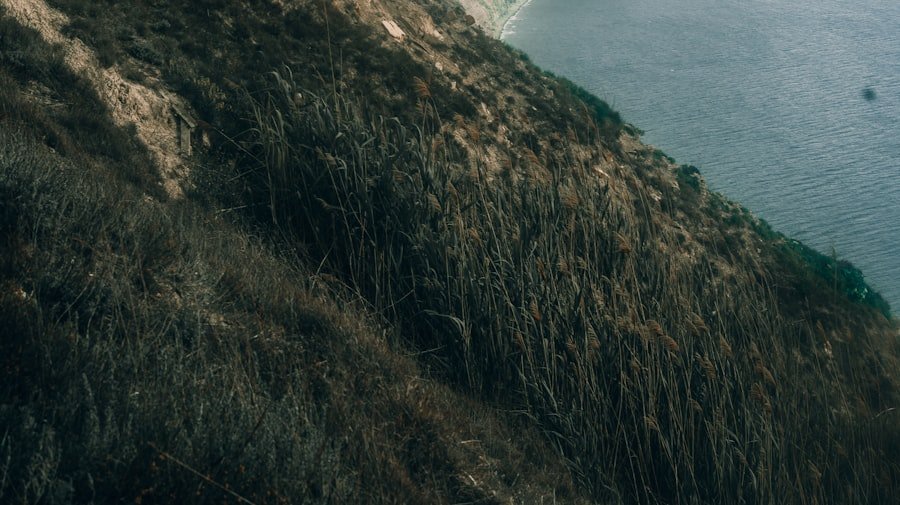
Do not set up a tent or sleep overnight wherever you find an open space around Creux du Van. Neuchâtel Tourism states that wild camping is prohibited in the nature-reserve area. Parking in meadows or other unofficial places is also prohibited.
Camper-van travelers can use authorized pitches in places such as Noiraigue. For example, the official tourism listing for Noiraigue Le Devins identifies it as a camper site close to the starting area for Creux du Van and Areuse Gorge hikes. Check current prices, restrictions, and available services before arriving.
If you prefer a room, Noiraigue and other Val-de-Travers communities provide hotels, guesthouses, holiday apartments, and similar accommodation. L’Auberge de Noiraigue, for example, is listed by regional tourism close to the railway station and the hiking routes.
Staying nearby can make an early start easier. It also gives you more flexibility if the weather forecast suggests that morning conditions will be better than the afternoon.
Best Times to Visit Creux du Van
The standard Sentier du Creux du Van route is listed for May through October. Within that period, the best month depends on what you want from the hike.
Late Spring and Early Summer
May and June can be attractive for fresh vegetation and flowering plants. Higher or shaded areas can still feel cool, so carry layers and confirm that the route is free of problematic snow or ice before starting.
Summer
July and August offer long daylight hours and generally give you more time to complete the full circuit without rushing. Warm days also make carrying enough water especially important.
Autumn
September and October can combine comfortable hiking temperatures with autumn color in the forests and open views across the Jura landscape. Shorter daylight means you should start early enough to finish before dark.
Winter and Early Spring
Winter changes the trip completely. Snow, ice, uncleared trails, closed roads, and reduced daylight can turn an ordinary summer hiking path into a much more serious outing. Do not use the summer route time or difficulty rating as your only guide in winter.
Other Attractions Near Creux du Van
The Creux du Van hike can easily be combined with other places in the Neuchâtel and Val-de-Travers region. The Areuse Gorge is another well-known walking destination accessible from the Noiraigue area and offers a very different landscape of river, forest, cliffs, bridges, and narrow gorge sections.
Val-de-Travers is also closely associated with absinthe. Visitors interested in the region’s cultural history can visit the Maison de l’Absinthe in Môtiers, which explains the drink’s production, history, prohibition, and regional heritage.
Neuchâtel itself is another useful stop, especially if you are traveling through the area by public transport. Its lakefront, historic center, restaurants, museums, and transport connections make it a practical base for exploring the wider region.
Creux du Van works best when you choose the visit that matches your time and fitness. Strong hikers can complete the full Noiraigue circuit, while visitors mainly interested in the panorama can use a shorter seasonal approach. Either way, current weather, trail conditions, parking restrictions, and reserve rules should be checked before departure.
If you want a fresh fruit idea for your hiking food, the site’s existing guide to Asian melons offers another snack option to consider. Pack cut fruit in a sealed container, keep it cool when necessary, and carry all food waste and packaging back out with you.
Frequently Asked Questions
What is Creux du Van?
Creux du Van is a large natural limestone cirque in the Jura Mountains of western Switzerland. Its rock wall reaches about 160 meters high, and the landscape was shaped by long-term erosion from water and ice.
How long is the Creux du Van hike?
The standard SwitzerlandMobility circular route from Noiraigue is about 15 km and takes approximately 4 hours 35 minutes of walking time. It includes about 780 m of ascent and descent. Add extra time for breaks, photographs, and meals.
How difficult is the Creux du Van hike?
The standard route is technically classified as an easy hiking trail, but its physical requirement is medium because you gain about 780 m in elevation. The direct 14 Contours climb is a strenuous ascent for people who are not used to hill walking.
What are the main highlights of the Creux du Van hike?
Highlights include the huge limestone amphitheater, panoramic views from the rim, forest and Jura pasture scenery, the 14 Contours path, and the possibility of seeing wildlife such as ibex or chamois.
Are there food or restroom facilities along the hike?
There are seasonal businesses in the wider route area, including a restaurant at Le Soliat, but you should not rely on food, water, or toilets being available when you arrive. Carry enough water and food to complete your hike independently.
Can you hike Creux du Van year-round?
The standard hiking route is listed for May through October. Winter visits are possible in some conditions, but snow, ice, slippery paths, uncleared roads, and different equipment requirements mean you should not treat winter as the same hike.
Is there an entrance fee for Creux du Van?
There is no general admission gate or standard hiking ticket for visiting the natural site. You may still need to pay for public transport, parking, food, accommodation, or guided activities.
Can you drive close to Creux du Van?
Yes, seasonal road access can bring you much closer to the rim than the full Noiraigue hike. From May through October, the Soliat car park is listed at about a five-minute walk from the edge. Access changes in winter, so check official road information before driving up.
Can you camp at Creux du Van?
Wild camping in the nature-reserve area is prohibited. Use an authorized campground or designated camper site in the surrounding region instead.
Should you bring a dog on the Creux du Van hike?
Use caution. Suckler cows may graze around Creux du Van and Le Soliat, and local tourism strongly advises against bringing dogs on the 14 Contours route when these cattle are present. Check current signs and livestock conditions before your hike.
Sources
- SwitzerlandMobility: Sentier du Creux du Van, Route 286 — route distance, duration, ascent, difficulty, and mapped hiking information
- Switzerland Tourism: Sentier du Creux du Van — cliff height, hiking statistics, landscape, and wildlife information
- Neuchâtel Tourism: Access and Parking at Creux du Van — seasonal road access, official parking, winter conditions, camper access, and wild-camping restrictions
- Neuchâtel Tourism: Trail of the 14 Contours — direct ascent information, difficulty, livestock warning, and Le Soliat facilities
- Canton of Neuchâtel: Protected Territories — Creux du Van’s protected landscape, nature reserve, ecological value, and wildlife-protection status